This weather event on June 14, 2025 includes:
3 states
32 counties,
17 cities,
and 82 zip codes.
There were 42976 total properties that were impacted and have possible damage.
States Impacted By Hail On June 14, 2025
Arkansas
·
Louisiana
·
Texas
Counties Impacted By Hail On June 14, 2025
Columbia, AR
·
Lafayette, AR
·
Miller, AR
·
Montgomery, AR
·
Ouachita, AR
·
Polk, AR
·
Union, AR
·
Bossier, LA
·
Caddo, LA
·
Catahoula, LA
·
Claiborne, LA
·
De Soto, LA
·
LaSalle, LA
·
Natchitoches, LA
·
Rapides, LA
·
Red River, LA
·
Sabine, LA
·
Vernon, LA
·
Webster, LA
·
Winn, LA
·
Bowie, TX
·
Cass, TX
·
Franklin, TX
·
Harrison, TX
·
Marion, TX
·
Newton, TX
·
Panola, TX
·
Red River, TX
·
Rusk, TX
·
Sabine, TX
·
Titus, TX
·
Upshur, TX
Cities Impacted By Hail On June 14, 2025
Bossier City, LA
·
Douglassville, TX
·
Eastwood, LA
·
Greenwood, LA
·
Haughton, LA
·
Jordan Hill, LA
·
Lakeview, LA
·
Marietta, TX
·
Milam, TX
·
Mount Ida, AR
·
Robeline, LA
·
Shreveport, LA
·
South Toledo Bend, TX
·
Stonewall, LA
·
Texarkana, AR
·
Vivian, LA
·
Waskom, TX
Zip Codes Impacted By Hail On June 14, 2025
70656
·
71006
·
71019
·
71023
·
71024
·
71033
·
71037
·
71038
·
71040
·
71047
·
71051
·
71055
·
71060
·
71063
·
71067
·
71069
·
71073
·
71078
·
71082
·
71101
·
71103
·
71104
·
71105
·
71106
·
71107
·
71108
·
71109
·
71110
·
71111
·
71112
·
71115
·
71118
·
71119
·
71129
·
71343
·
71371
·
71403
·
71427
·
71446
·
71447
·
71449
·
71455
·
71469
·
71483
·
71701
·
71747
·
71751
·
71765
·
71826
·
71834
·
71845
·
71854
·
71937
·
71945
·
71957
·
71972
·
75426
·
75455
·
75457
·
75551
·
75554
·
75555
·
75560
·
75562
·
75566
·
75567
·
75568
·
75639
·
75640
·
75645
·
75652
·
75654
·
75657
·
75661
·
75672
·
75692
·
75932
·
75948
·
71953
·
71752
·
71052
·
71007
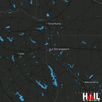 SHREVEPORT (KSHV) RADAR

