This weather event on June 13, 2025 includes:
4 states
26 counties,
10 cities,
and 65 zip codes.
There were 482 total properties that were impacted and have possible damage.
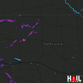 NORTH PLATTE (KLNX) RADAR
States Impacted By Hail On June 13, 2025
Colorado
·
Kansas
·
Nebraska
·
South Dakota
Counties Impacted By Hail On June 13, 2025
Logan, CO
·
Phillips, CO
·
Sedgwick, CO
·
Yuma, CO
·
Decatur, KS
·
Rawlins, KS
·
Box Butte, NE
·
Chase, NE
·
Cherry, NE
·
Cheyenne, NE
·
Dawes, NE
·
Deuel, NE
·
Dundy, NE
·
Garden, NE
·
Grant, NE
·
Hayes, NE
·
Hitchcock, NE
·
Hooker, NE
·
Lincoln, NE
·
Morrill, NE
·
Perkins, NE
·
Red Willow, NE
·
Sheridan, NE
·
Bennett, SD
·
Gregory, SD
·
Oglala Lakota, SD
Cities Impacted By Hail On June 13, 2025
Alliance, NE
·
Benkelman, NE
·
Chadron, NE
·
Clinton, NE
·
Gordon, NE
·
Holyoke, CO
·
Hyannis, NE
·
Lorenzo, NE
·
Stratton, NE
·
Wauneta, NE
Zip Codes Impacted By Hail On June 13, 2025
57317
·
57335
·
57551
·
57571
·
57716
·
67730
·
67745
·
67749
·
69001
·
69021
·
69023
·
69024
·
69030
·
69037
·
69041
·
69043
·
69044
·
69045
·
69101
·
69122
·
69125
·
69129
·
69131
·
69141
·
69147
·
69149
·
69152
·
69154
·
69156
·
69162
·
69166
·
69168
·
69201
·
69211
·
69212
·
69216
·
69218
·
69219
·
69301
·
69331
·
69333
·
69335
·
69336
·
69337
·
69339
·
69343
·
69347
·
69348
·
69350
·
69351
·
69354
·
69360
·
69366
·
69367
·
80721
·
80726
·
80728
·
80731
·
80734
·
80736
·
80737
·
80744
·
80747
·
80749
·
80758

