This weather event on June 12, 2025 includes:
3 states
29 counties,
14 cities,
and 85 zip codes.
There were 233 total properties that were impacted and have possible damage.
States Impacted By Hail On June 12, 2025
Colorado
·
Kansas
·
Nebraska
Counties Impacted By Hail On June 12, 2025
Logan, CO
·
Morgan, CO
·
Phillips, CO
·
Sedgwick, CO
·
Washington, CO
·
Yuma, CO
·
Cheyenne, KS
·
Decatur, KS
·
Gove, KS
·
Hodgeman, KS
·
Lane, KS
·
Logan, KS
·
Ness, KS
·
Rawlins, KS
·
Thomas, KS
·
Trego, KS
·
Arthur, NE
·
Chase, NE
·
Cheyenne, NE
·
Deuel, NE
·
Dundy, NE
·
Frontier, NE
·
Garden, NE
·
Hayes, NE
·
Hitchcock, NE
·
Keith, NE
·
Lincoln, NE
·
Perkins, NE
·
Red Willow, NE
Cities Impacted By Hail On June 12, 2025
Bazine, KS
·
Imperial, NE
·
Jetmore, KS
·
Lorenzo, NE
·
McCook, NE
·
Oakley, KS
·
Ogallala, NE
·
Ovid, CO
·
Paxton, NE
·
Peetz, CO
·
Ransom, KS
·
Sarben, NE
·
Sterling, CO
·
Trenton, NE
Zip Codes Impacted By Hail On June 12, 2025
67515
·
67516
·
67518
·
67521
·
67556
·
67560
·
67572
·
67584
·
67653
·
67701
·
67730
·
67731
·
67732
·
67734
·
67736
·
67737
·
67738
·
67739
·
67743
·
67744
·
67745
·
67747
·
67748
·
67749
·
67752
·
67764
·
67839
·
67849
·
67876
·
69001
·
69021
·
69023
·
69024
·
69025
·
69026
·
69027
·
69030
·
69032
·
69033
·
69034
·
69037
·
69038
·
69040
·
69041
·
69043
·
69044
·
69045
·
69121
·
69122
·
69127
·
69129
·
69132
·
69134
·
69140
·
69144
·
69146
·
69147
·
69149
·
69150
·
69153
·
69154
·
69155
·
69162
·
69165
·
69168
·
69169
·
80701
·
80720
·
80721
·
80722
·
80723
·
80726
·
80728
·
80734
·
80737
·
80741
·
80744
·
80745
·
80747
·
80749
·
80750
·
80751
·
80758
·
80759
·
67854
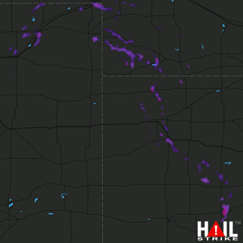 GOODLAND (KGLD) RADAR

