This weather event on June 12, 2025 includes:
3 states
20 counties,
18 cities,
and 57 zip codes.
There were 211 total properties that were impacted and have possible damage.
States Impacted By Hail On June 12, 2025
Iowa
·
Illinois
·
Wisconsin
Counties Impacted By Hail On June 12, 2025
Butler, IA
·
Chickasaw, IA
·
Clayton, IA
·
Delaware, IA
·
Dubuque, IA
·
Fayette, IA
·
Hardin, IA
·
Henry, IA
·
Jasper, IA
·
Louisa, IA
·
Lucas, IA
·
Marion, IA
·
Marshall, IA
·
Monroe, IA
·
Muscatine, IA
·
Scott, IA
·
Story, IA
·
Stephenson, IL
·
Grant, WI
·
Green, WI
Cities Impacted By Hail On June 12, 2025
Arlington, IA
·
Bagley, WI
·
Baxter, IA
·
Blue Grass, IA
·
Bristow, IA
·
Buffalo, IA
·
Clayton, IA
·
Dumont, IA
·
Dundee, IA
·
Edgewood, IA
·
Eldora, IA
·
Freeport, IL
·
Holy Cross, IA
·
Melbourne, IA
·
Rhodes, IA
·
Russell, IA
·
Strawberry Point, IA
·
Zearing, IA
Zip Codes Impacted By Hail On June 12, 2025
50005
·
50028
·
50044
·
50049
·
50054
·
50055
·
50056
·
50057
·
50116
·
50127
·
50138
·
50150
·
50158
·
50162
·
50168
·
50170
·
50208
·
50238
·
50247
·
50258
·
50278
·
50601
·
50602
·
50604
·
50606
·
50611
·
50625
·
50627
·
50630
·
50672
·
50674
·
52035
·
52038
·
52039
·
52042
·
52043
·
52048
·
52049
·
52050
·
52052
·
52053
·
52057
·
52065
·
52076
·
52077
·
52157
·
52169
·
52621
·
52659
·
52726
·
52728
·
52738
·
53566
·
53801
·
61032
·
61048
·
50234
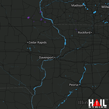 DAVENPORT (KDVN) RADAR

