This weather event on June 11, 2025 includes:
3 states
26 counties,
12 cities,
and 57 zip codes.
There were 984 total properties that were impacted and have possible damage.
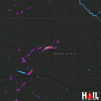 NORTH PLATTE (KLNX) RADAR
States Impacted By Hail On June 11, 2025
Colorado
·
Nebraska
·
South Dakota
Counties Impacted By Hail On June 11, 2025
Phillips, CO
·
Sedgwick, CO
·
Yuma, CO
·
Arthur, NE
·
Blaine, NE
·
Brown, NE
·
Chase, NE
·
Cherry, NE
·
Deuel, NE
·
Dundy, NE
·
Garden, NE
·
Grant, NE
·
Hayes, NE
·
Hooker, NE
·
Keith, NE
·
McPherson, NE
·
Perkins, NE
·
Sheridan, NE
·
Thomas, NE
·
Bennett, SD
·
Gregory, SD
·
Jackson, SD
·
Mellette, SD
·
Oglala Lakota, SD
·
Todd, SD
·
Tripp, SD
Cities Impacted By Hail On June 11, 2025
Grant, NE
·
Interior, SD
·
Julesburg, CO
·
Keystone, NE
·
Kyle, SD
·
Manderson-White Horse Creek, SD
·
Mullen, NE
·
Paoli, CO
·
Porcupine, SD
·
Seneca, NE
·
Venango, NE
·
Wood, SD
Zip Codes Impacted By Hail On June 11, 2025
57529
·
57534
·
57541
·
57547
·
57551
·
57555
·
57560
·
57567
·
57577
·
57579
·
57584
·
57585
·
57714
·
57716
·
57750
·
57752
·
57756
·
57764
·
57770
·
57772
·
69023
·
69030
·
69032
·
69040
·
69045
·
69121
·
69122
·
69129
·
69135
·
69140
·
69142
·
69144
·
69147
·
69152
·
69153
·
69155
·
69157
·
69161
·
69165
·
69166
·
69168
·
69210
·
69221
·
69335
·
69343
·
69350
·
69366
·
80721
·
80731
·
80734
·
80737
·
80746
·
80758
·
57521
·
57528
·
57566
·
69333

