This weather event on June 6, 2025 includes:
2 states
21 counties,
16 cities,
and 60 zip codes.
There were 1948 total properties that were impacted and have possible damage.
States Impacted By Hail On June 6, 2025
Alabama
·
Georgia
Counties Impacted By Hail On June 6, 2025
Autauga, AL
·
Barbour, AL
·
Bullock, AL
·
Butler, AL
·
Coosa, AL
·
Dallas, AL
·
Elmore, AL
·
Lee, AL
·
Lowndes, AL
·
Macon, AL
·
Montgomery, AL
·
Russell, AL
·
Shelby, AL
·
Talladega, AL
·
Tallapoosa, AL
·
Wilcox, AL
·
Chattooga, GA
·
Floyd, GA
·
Gordon, GA
·
Gwinnett, GA
·
Walton, GA
Cities Impacted By Hail On June 6, 2025
Auburn, AL
·
Blue Ridge, AL
·
Emerald Mountain, AL
·
Grayson, GA
·
Hayneville, AL
·
Lawrenceville, GA
·
Montgomery, AL
·
Mosses, AL
·
Pike Road, AL
·
Redland, AL
·
Shorter, AL
·
Snellville, GA
·
Talladega Springs, AL
·
Tallassee, AL
·
Tuskegee, AL
·
Wetumpka, AL
Zip Codes Impacted By Hail On June 6, 2025
30017
·
30045
·
30046
·
30047
·
30052
·
30078
·
30103
·
30105
·
30161
·
30165
·
30701
·
30733
·
30747
·
35044
·
35136
·
35143
·
35151
·
36024
·
36027
·
36029
·
36030
·
36040
·
36043
·
36047
·
36052
·
36053
·
36069
·
36075
·
36078
·
36083
·
36088
·
36089
·
36092
·
36093
·
36104
·
36105
·
36108
·
36110
·
36111
·
36112
·
36113
·
36116
·
36117
·
36701
·
36703
·
36726
·
36749
·
36758
·
36761
·
36768
·
36785
·
36830
·
36832
·
36850
·
36853
·
36860
·
36866
·
36879
·
36871
·
36037
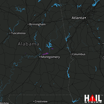 MONTGOMERY (KMXX) RADAR

