This weather event on June 6, 2025 includes:
4 states
30 counties,
14 cities,
and 57 zip codes.
There were 84 total properties that were impacted and have possible damage.
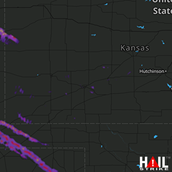 DODGE CITY (KDDC) RADAR
States Impacted By Hail On June 6, 2025
Colorado
·
Kansas
·
Oklahoma
·
Texas
Counties Impacted By Hail On June 6, 2025
Baca, CO
·
Cheyenne, CO
·
Prowers, CO
·
Edwards, KS
·
Finney, KS
·
Ford, KS
·
Grant, KS
·
Gray, KS
·
Greeley, KS
·
Hamilton, KS
·
Haskell, KS
·
Hodgeman, KS
·
Meade, KS
·
Morton, KS
·
Pawnee, KS
·
Seward, KS
·
Stafford, KS
·
Stanton, KS
·
Stevens, KS
·
Wallace, KS
·
Wichita, KS
·
Beaver, OK
·
Cimarron, OK
·
Texas, OK
·
Hansford, TX
·
Hemphill, TX
·
Hutchinson, TX
·
Ochiltree, TX
·
Roberts, TX
·
Sherman, TX
Cities Impacted By Hail On June 6, 2025
Dodge City, KS
·
Elkhart, KS
·
Ford, KS
·
Goodwell, OK
·
Greeley County unified government (balance), KS
·
Guymon, OK
·
Keyes, OK
·
Montezuma, KS
·
Rolla, KS
·
Spearman, TX
·
Texhoma, OK
·
Texhoma, TX
·
Ulysses, KS
·
Wright, KS
Zip Codes Impacted By Hail On June 6, 2025
67523
·
67529
·
67547
·
67552
·
67557
·
67563
·
67574
·
67576
·
67758
·
67762
·
67801
·
67834
·
67835
·
67841
·
67842
·
67849
·
67853
·
67854
·
67855
·
67857
·
67861
·
67862
·
67864
·
67865
·
67867
·
67870
·
67876
·
67877
·
67878
·
67879
·
67880
·
67950
·
67951
·
67953
·
67954
·
73931
·
73933
·
73939
·
73944
·
73945
·
73947
·
73949
·
79014
·
79040
·
79059
·
79070
·
79081
·
80802
·
81029
·
81041
·
81052
·
81073
·
81084
·
81090
·
79084
·
73942
·
67882

