This weather event on June 6, 2025 includes:
4 states
30 counties,
18 cities,
and 80 zip codes.
There were 147 total properties that were impacted and have possible damage.
States Impacted By Hail On June 6, 2025
Alabama
·
Kentucky
·
Mississippi
·
Tennessee
Counties Impacted By Hail On June 6, 2025
Lauderdale, AL
·
Adair, KY
·
Calloway, KY
·
Russell, KY
·
Alcorn, MS
·
Tishomingo, MS
·
Benton, TN
·
Clay, TN
·
Davidson, TN
·
Decatur, TN
·
Dickson, TN
·
Giles, TN
·
Hardin, TN
·
Henderson, TN
·
Hickman, TN
·
Houston, TN
·
Humphreys, TN
·
Jackson, TN
·
Lawrence, TN
·
Lewis, TN
·
Lincoln, TN
·
Marshall, TN
·
Maury, TN
·
McNairy, TN
·
Montgomery, TN
·
Perry, TN
·
Stewart, TN
·
Wayne, TN
·
Williamson, TN
·
Wilson, TN
Cities Impacted By Hail On June 6, 2025
Burns, TN
·
Clarksville, TN
·
Clifton, TN
·
Cornersville, TN
·
Decaturville, TN
·
Dickson, TN
·
Elkton, TN
·
Erin, TN
·
Fairview, TN
·
Lyles, TN
·
McEwen, TN
·
Michie, TN
·
Mount Juliet, TN
·
Nashville-Davidson metropolitan government (balance), TN
·
Petersburg, TN
·
Spring Hill, TN
·
Stantonville, TN
·
Wrigley, TN
Zip Codes Impacted By Hail On June 6, 2025
35633
·
35645
·
35648
·
35677
·
37010
·
37013
·
37025
·
37029
·
37033
·
37034
·
37040
·
37042
·
37043
·
37047
·
37055
·
37061
·
37062
·
37064
·
37076
·
37078
·
37079
·
37091
·
37097
·
37098
·
37101
·
37122
·
37137
·
37144
·
37150
·
37174
·
37175
·
37179
·
37185
·
37191
·
37210
·
37214
·
37334
·
38221
·
38310
·
38311
·
38326
·
38328
·
38329
·
38341
·
38351
·
38357
·
38361
·
38363
·
38372
·
38375
·
38376
·
38379
·
38388
·
38401
·
38425
·
38449
·
38450
·
38451
·
38455
·
38456
·
38464
·
38471
·
38472
·
38474
·
38475
·
38477
·
38482
·
38483
·
38588
·
38834
·
38852
·
42049
·
42071
·
42629
·
42642
·
42728
·
42741
·
38476
·
38453
·
37096
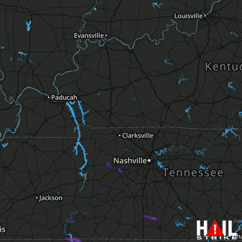 FORT CAMPBELL (KHPX) RADAR

