This weather event on May 31, 2025 includes:
1 states
15 counties,
21 cities,
and 80 zip codes.
There were 293 total properties that were impacted and have possible damage.
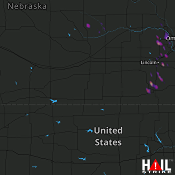 HASTINGS (KUEX) RADAR
States Impacted By Hail On May 31, 2025
Nebraska
Counties Impacted By Hail On May 31, 2025
Boone, NE
·
Cass, NE
·
Clay, NE
·
Dodge, NE
·
Douglas, NE
·
Gage, NE
·
Greeley, NE
·
Jefferson, NE
·
Johnson, NE
·
Lancaster, NE
·
Nance, NE
·
Nemaha, NE
·
Otoe, NE
·
Richardson, NE
·
Saunders, NE
Cities Impacted By Hail On May 31, 2025
Beatrice, NE
·
Cedar Bluffs, NE
·
Davey, NE
·
Dawson, NE
·
Firth, NE
·
Greenwood, NE
·
Johnson, NE
·
Leshara, NE
·
Lincoln, NE
·
Mead, NE
·
Otoe, NE
·
Pickrell, NE
·
Plymouth, NE
·
Salem, NE
·
Talmage, NE
·
Wahoo, NE
·
Walton, NE
·
Wann, NE
·
Waverly, NE
·
Woodland Hills, NE
·
Yankee Hill, NE
Zip Codes Impacted By Hail On May 31, 2025
68003
·
68015
·
68017
·
68018
·
68025
·
68031
·
68033
·
68040
·
68041
·
68064
·
68066
·
68070
·
68073
·
68301
·
68304
·
68305
·
68307
·
68310
·
68317
·
68320
·
68324
·
68328
·
68329
·
68331
·
68333
·
68336
·
68337
·
68341
·
68346
·
68347
·
68358
·
68366
·
68368
·
68372
·
68376
·
68377
·
68378
·
68404
·
68417
·
68418
·
68422
·
68424
·
68428
·
68430
·
68433
·
68442
·
68446
·
68448
·
68457
·
68461
·
68462
·
68463
·
68465
·
68502
·
68504
·
68507
·
68510
·
68512
·
68514
·
68516
·
68517
·
68520
·
68521
·
68522
·
68523
·
68524
·
68526
·
68527
·
68528
·
68531
·
68621
·
68623
·
68627
·
68638
·
68665
·
68842
·
68864
·
68882
·
68933
·
68938

