This weather event on May 30, 2025 includes:
3 states
27 counties,
19 cities,
and 72 zip codes.
There were 4897 total properties that were impacted and have possible damage.
States Impacted By Hail On May 30, 2025
North Carolina
·
Virginia
·
West Virginia
Counties Impacted By Hail On May 30, 2025
Alamance, NC
·
Davidson, NC
·
Davie, NC
·
Forsyth, NC
·
Guilford, NC
·
Orange, NC
·
Yadkin, NC
·
Amelia, VA
·
Amherst, VA
·
Appomattox, VA
·
Augusta, VA
·
Bedford, VA
·
Buckingham, VA
·
Campbell, VA
·
Charlotte, VA
·
Cumberland, VA
·
Franklin, VA
·
Halifax, VA
·
Lunenburg, VA
·
Lynchburg, VA
·
Mecklenburg, VA
·
Nottoway, VA
·
Page, VA
·
Pittsylvania, VA
·
Prince Edward, VA
·
Rockingham, VA
·
Pocahontas, WV
Cities Impacted By Hail On May 30, 2025
Bedford, VA
·
Bermuda Run, NC
·
Big Island, VA
·
Clemmons, NC
·
Concord, VA
·
East Bend, NC
·
Farmville, VA
·
Forest, VA
·
Hampden-Sydney, VA
·
Lynchburg, VA
·
Massanutten, VA
·
Oak Ridge, NC
·
Pamplin City, VA
·
Penhook, VA
·
Rustburg, VA
·
Stanley, VA
·
Thomasville, NC
·
Timberlake, VA
·
Tobaccoville, NC
Zip Codes Impacted By Hail On May 30, 2025
22802
·
22812
·
22827
·
22832
·
22835
·
22840
·
22843
·
22849
·
22851
·
23002
·
23083
·
23901
·
23909
·
23924
·
23930
·
23937
·
23943
·
23958
·
23959
·
23960
·
23962
·
23963
·
23966
·
23967
·
23974
·
24088
·
24104
·
24121
·
24137
·
24139
·
24151
·
24501
·
24502
·
24503
·
24504
·
24522
·
24523
·
24526
·
24528
·
24530
·
24531
·
24534
·
24538
·
24550
·
24551
·
24554
·
24556
·
24569
·
24570
·
24571
·
24574
·
24577
·
24588
·
24593
·
24915
·
24944
·
27006
·
27009
·
27012
·
27018
·
27050
·
27051
·
27214
·
27217
·
27231
·
27243
·
27244
·
27249
·
27278
·
27284
·
27360
·
27455
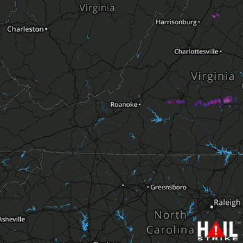 ROANOKE (KFCX) RADAR

