This weather event on May 28, 2025 includes:
5 states
30 counties,
17 cities,
and 80 zip codes.
There were 71 total properties that were impacted and have possible damage.
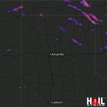 AMARILLO (KAMA) RADAR
States Impacted By Hail On May 28, 2025
Colorado
·
Kansas
·
New Mexico
·
Oklahoma
·
Texas
Counties Impacted By Hail On May 28, 2025
Baca, CO
·
Meade, KS
·
Morton, KS
·
Seward, KS
·
Stevens, KS
·
Guadalupe, NM
·
San Miguel, NM
·
Union, NM
·
Beaver, OK
·
Beckham, OK
·
Cimarron, OK
·
Custer, OK
·
Dewey, OK
·
Ellis, OK
·
Roger Mills, OK
·
Texas, OK
·
Washita, OK
·
Woodward, OK
·
Childress, TX
·
Dallam, TX
·
Gray, TX
·
Hansford, TX
·
Hemphill, TX
·
Hutchinson, TX
·
Lipscomb, TX
·
Moore, TX
·
Ochiltree, TX
·
Roberts, TX
·
Sherman, TX
·
Wheeler, TX
Cities Impacted By Hail On May 28, 2025
Burns Flat, OK
·
Butler, OK
·
Darrouzett, TX
·
Elk City, OK
·
Elkhart, KS
·
Forgan, OK
·
Gage, OK
·
Grenville, NM
·
Hugoton, KS
·
Leedey, OK
·
Liberal, KS
·
Perryton, TX
·
Sayre, OK
·
Shattuck, OK
·
Sweetwater, OK
·
Tyrone, OK
·
Wheeler, TX
Zip Codes Impacted By Hail On May 28, 2025
67859
·
67864
·
67869
·
67901
·
67950
·
67951
·
67953
·
67954
·
73620
·
73624
·
73625
·
73626
·
73627
·
73628
·
73638
·
73642
·
73644
·
73645
·
73647
·
73650
·
73654
·
73662
·
73664
·
73801
·
73832
·
73840
·
73843
·
73844
·
73848
·
73858
·
73931
·
73932
·
73933
·
73937
·
73938
·
73939
·
73945
·
73949
·
73950
·
73951
·
79003
·
79005
·
79007
·
79011
·
79014
·
79018
·
79022
·
79024
·
79029
·
79033
·
79034
·
79040
·
79046
·
79051
·
79058
·
79059
·
79061
·
79062
·
79065
·
79070
·
79079
·
79080
·
79081
·
79083
·
79084
·
79093
·
79201
·
81029
·
81073
·
81090
·
88401
·
88415
·
88416
·
88418
·
88419
·
88431
·
73666
·
73859
·
79096
·
88424

