This weather event on May 26, 2025 includes:
2 states
29 counties,
15 cities,
and 79 zip codes.
There were 526 total properties that were impacted and have possible damage.
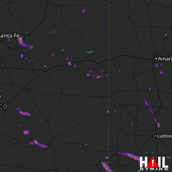 CANNON AFB (KFDX) RADAR
States Impacted By Hail On May 26, 2025
New Mexico
·
Texas
Counties Impacted By Hail On May 26, 2025
Chaves, NM
·
Curry, NM
·
De Baca, NM
·
Guadalupe, NM
·
Harding, NM
·
Lea, NM
·
Lincoln, NM
·
Mora, NM
·
Quay, NM
·
San Miguel, NM
·
Santa Fe, NM
·
Torrance, NM
·
Union, NM
·
Armstrong, TX
·
Briscoe, TX
·
Castro, TX
·
Dawson, TX
·
Deaf Smith, TX
·
Gaines, TX
·
Hale, TX
·
Hartley, TX
·
Hockley, TX
·
Lamb, TX
·
Lubbock, TX
·
Lynn, TX
·
Randall, TX
·
Swisher, TX
·
Terry, TX
·
Yoakum, TX
Cities Impacted By Hail On May 26, 2025
Abernathy, TX
·
Anton Chico, NM
·
Canyon, TX
·
Grady, NM
·
Hart, TX
·
Lake Tanglewood, TX
·
Las Vegas, NM
·
Llano del Medio, NM
·
Moriarty, NM
·
North Hobbs, NM
·
Palisades, TX
·
Plains, TX
·
Tecolotito, NM
·
Timbercreek Canyon, TX
·
Welch, TX
Zip Codes Impacted By Hail On May 26, 2025
79015
·
79019
·
79021
·
79022
·
79032
·
79041
·
79042
·
79043
·
79045
·
79063
·
79064
·
79072
·
79088
·
79094
·
79119
·
79257
·
79311
·
79316
·
79323
·
79329
·
79336
·
79342
·
79351
·
79355
·
79360
·
79376
·
79377
·
79378
·
79403
·
87015
·
87016
·
87035
·
87036
·
87056
·
87063
·
87538
·
87552
·
87569
·
87573
·
87583
·
87701
·
87711
·
87724
·
87731
·
87742
·
87743
·
87745
·
87752
·
88101
·
88112
·
88119
·
88120
·
88124
·
88201
·
88203
·
88240
·
88242
·
88267
·
88316
·
88318
·
88321
·
88343
·
88351
·
88401
·
88410
·
88411
·
88415
·
88416
·
88421
·
88424
·
88426
·
88427
·
88431
·
88434
·
88435
·
88260
·
88116
·
79118
·
79035

