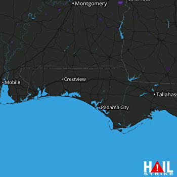
This weather event on May 26, 2025 includes:
3 states
32 counties,
19 cities,
and 84 zip codes.
There were total properties that were impacted and have possible damage.
States Impacted By Hail On May 26, 2025
Alabama
·
Florida
·
Georgia
Counties Impacted By Hail On May 26, 2025
Autauga, AL
·
Barbour, AL
·
Bullock, AL
·
Butler, AL
·
Clarke, AL
·
Coffee, AL
·
Conecuh, AL
·
Crenshaw, AL
·
Dale, AL
·
Dallas, AL
·
Henry, AL
·
Lowndes, AL
·
Macon, AL
·
Marengo, AL
·
Monroe, AL
·
Montgomery, AL
·
Pike, AL
·
Russell, AL
·
Wilcox, AL
·
Okaloosa, FL
·
Baker, GA
·
Brooks, GA
·
Calhoun, GA
·
Clay, GA
·
Colquitt, GA
·
Decatur, GA
·
Early, GA
·
Randolph, GA
·
Stewart, GA
·
Terrell, GA
·
Thomas, GA
·
Worth, GA
Cities Impacted By Hail On May 26, 2025
Arlington, GA
·
Bainbridge, GA
·
Brundidge, AL
·
Clayton, AL
·
Daleville, AL
·
Eufaula, AL
·
Fort Gaines, GA
·
Fort Rucker, AL
·
Gordonville, AL
·
Jackson, AL
·
Lowndesboro, AL
·
Mosses, AL
·
Newton, AL
·
Niceville, FL
·
Phenix City, AL
·
Richland, GA
·
Thomasville, AL
·
Troy, AL
·
Vredenburgh, AL
Zip Codes Impacted By Hail On May 26, 2025
31629
·
31643
·
31738
·
31744
·
31756
·
31757
·
31772
·
31773
·
31778
·
31791
·
31815
·
31825
·
32544
·
32548
·
32569
·
32578
·
36005
·
36010
·
36016
·
36027
·
36029
·
36030
·
36032
·
36033
·
36036
·
36037
·
36040
·
36041
·
36042
·
36046
·
36047
·
36053
·
36067
·
36069
·
36071
·
36079
·
36081
·
36083
·
36089
·
36108
·
36319
·
36322
·
36330
·
36345
·
36352
·
36362
·
36373
·
36425
·
36451
·
36456
·
36481
·
36482
·
36545
·
36701
·
36703
·
36726
·
36752
·
36761
·
36768
·
36769
·
36775
·
36784
·
36785
·
36860
·
36866
·
36869
·
36871
·
36875
·
39813
·
39815
·
39817
·
39819
·
39823
·
39836
·
39840
·
39842
·
39846
·
39851
·
39862
·
39867
·
39870
·
36049
·
36310
·
36401
 EGLIN AFB (KEVX) RADAR

