This weather event on May 25, 2025 includes:
4 states
28 counties,
11 cities,
and 57 zip codes.
There were total properties that were impacted and have possible damage.
States Impacted By Hail On May 25, 2025
Arkansas
·
Louisiana
·
Mississippi
·
Texas
Counties Impacted By Hail On May 25, 2025
Ashley, AR
·
Union, AR
·
Ascension, LA
·
Avoyelles, LA
·
Catahoula, LA
·
Concordia, LA
·
De Soto, LA
·
East Feliciana, LA
·
Grant, LA
·
LaSalle, LA
·
Livingston, LA
·
Morehouse, LA
·
Pointe Coupee, LA
·
St. Helena, LA
·
Tensas, LA
·
Union, LA
·
West Carroll, LA
·
West Feliciana, LA
·
Adams, MS
·
Amite, MS
·
Claiborne, MS
·
Copiah, MS
·
Franklin, MS
·
Jefferson, MS
·
Lincoln, MS
·
Wilkinson, MS
·
Marion, TX
·
Shelby, TX
Cities Impacted By Hail On May 25, 2025
Bordelonville, LA
·
Clayton, LA
·
Crosby, MS
·
Ferriday, LA
·
French Settlement, LA
·
Jena, LA
·
Midway, LA
·
Port Vincent, LA
·
Ridgecrest, LA
·
St. Francisville, LA
·
Walker, LA
Zip Codes Impacted By Hail On May 25, 2025
39083
·
39086
·
39120
·
39144
·
39150
·
39175
·
39601
·
39633
·
39638
·
39647
·
39653
·
39661
·
39668
·
39669
·
70441
·
70444
·
70453
·
70706
·
70712
·
70715
·
70722
·
70726
·
70733
·
70753
·
70754
·
70761
·
70769
·
70775
·
70782
·
70785
·
71032
·
71049
·
71223
·
71241
·
71260
·
71261
·
71263
·
71326
·
71331
·
71334
·
71339
·
71342
·
71343
·
71351
·
71354
·
71355
·
71369
·
71371
·
71373
·
71375
·
71432
·
71635
·
71747
·
71765
·
75657
·
75935
·
75975
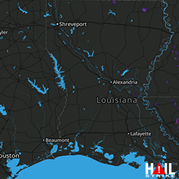 FORT POLK (KPOE) RADAR

