This weather event on May 25, 2025 includes:
2 states
29 counties,
21 cities,
and 81 zip codes.
There were 20118 total properties that were impacted and have possible damage.
States Impacted By Hail On May 25, 2025
Florida
·
Georgia
Counties Impacted By Hail On May 25, 2025
Bay, FL
·
Calhoun, FL
·
Franklin, FL
·
Gadsden, FL
·
Gulf, FL
·
Holmes, FL
·
Jefferson, FL
·
Lafayette, FL
·
Leon, FL
·
Liberty, FL
·
Okaloosa, FL
·
Wakulla, FL
·
Walton, FL
·
Washington, FL
·
Appling, GA
·
Atkinson, GA
·
Ben Hill, GA
·
Berrien, GA
·
Brooks, GA
·
Clinch, GA
·
Coffee, GA
·
Colquitt, GA
·
Grady, GA
·
Irwin, GA
·
Jeff Davis, GA
·
Lanier, GA
·
Lowndes, GA
·
Telfair, GA
·
Thomas, GA
Cities Impacted By Hail On May 25, 2025
Cairo, GA
·
Coolidge, GA
·
Crawfordville, FL
·
Dasher, GA
·
Freeport, FL
·
Hazlehurst, GA
·
Jacksonville, GA
·
Meigs, GA
·
Midway, FL
·
Niceville, FL
·
Panama City, FL
·
Panama City Beach, FL
·
Quitman, GA
·
Satilla, GA
·
Tallahassee, FL
·
Thomasville, GA
·
Valparaiso, FL
·
Waukeenah, FL
·
Westville, FL
·
Willacoochee, GA
·
Woodville, FL
Zip Codes Impacted By Hail On May 25, 2025
31512
·
31513
·
31519
·
31532
·
31535
·
31539
·
31544
·
31549
·
31601
·
31605
·
31606
·
31622
·
31626
·
31629
·
31630
·
31634
·
31635
·
31636
·
31639
·
31641
·
31642
·
31643
·
31645
·
31650
·
31699
·
31738
·
31749
·
31750
·
31757
·
31765
·
31768
·
31771
·
31773
·
31778
·
31788
·
31792
·
31798
·
32066
·
32301
·
32303
·
32304
·
32308
·
32309
·
32310
·
32311
·
32312
·
32317
·
32320
·
32322
·
32327
·
32333
·
32334
·
32336
·
32343
·
32344
·
32351
·
32358
·
32399
·
32404
·
32409
·
32413
·
32421
·
32424
·
32430
·
32433
·
32435
·
32437
·
32439
·
32449
·
32455
·
32462
·
32464
·
32465
·
32542
·
32547
·
32578
·
32580
·
39828
·
39897
·
32305
·
31779
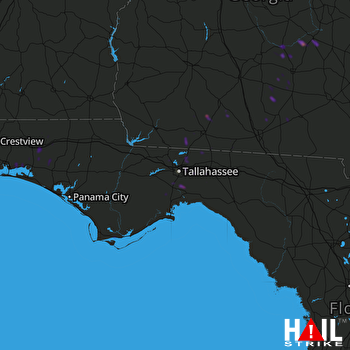 TALLAHASSEE (KTLH) RADAR

