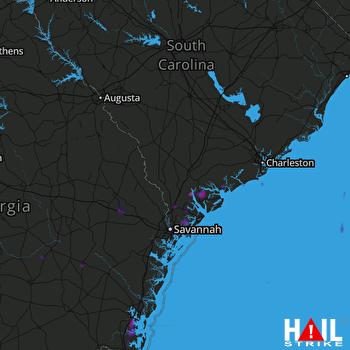
This weather event on May 25, 2025 includes:
3 states
21 counties,
26 cities,
and 67 zip codes.
There were 5204 total properties that were impacted and have possible damage.
States Impacted By Hail On May 25, 2025
Florida
·
Georgia
·
South Carolina
Counties Impacted By Hail On May 25, 2025
Nassau, FL
·
Appling, GA
·
Bryan, GA
·
Bulloch, GA
·
Camden, GA
·
Chatham, GA
·
Effingham, GA
·
Evans, GA
·
Glynn, GA
·
Jeff Davis, GA
·
Liberty, GA
·
Long, GA
·
Tattnall, GA
·
Toombs, GA
·
Wayne, GA
·
Allendale, SC
·
Beaufort, SC
·
Charleston, SC
·
Colleton, SC
·
Hampton, SC
·
Jasper, SC
Cities Impacted By Hail On May 25, 2025
Beaufort, SC
·
Bloomingdale, GA
·
Bluffton, SC
·
Brunswick, GA
·
Burton, SC
·
Claxton, GA
·
Dock Junction, GA
·
Guyton, GA
·
Hardeeville, SC
·
Isle of Hope, GA
·
Kingsland, GA
·
Laurel Bay, SC
·
Midway, GA
·
Montgomery, GA
·
Pooler, GA
·
Port Royal, SC
·
Port Wentworth, GA
·
Riceboro, GA
·
Ridgeland, SC
·
Satilla, GA
·
Savannah, GA
·
Seabrook Island, SC
·
Skidaway Island, GA
·
Statesboro, GA
·
Surrency, GA
·
Thunderbolt, GA
Zip Codes Impacted By Hail On May 25, 2025
29438
·
29446
·
29452
·
29455
·
29827
·
29902
·
29906
·
29907
·
29909
·
29910
·
29915
·
29916
·
29920
·
29927
·
29929
·
29932
·
29934
·
29936
·
29940
·
29941
·
29944
·
29945
·
30415
·
30417
·
30420
·
30421
·
30436
·
30452
·
30453
·
30458
·
31302
·
31307
·
31308
·
31312
·
31316
·
31320
·
31321
·
31322
·
31323
·
31326
·
31329
·
31401
·
31404
·
31405
·
31406
·
31407
·
31409
·
31410
·
31411
·
31419
·
31513
·
31520
·
31523
·
31525
·
31532
·
31539
·
31548
·
31555
·
31560
·
31563
·
31565
·
31568
·
31569
·
32097
·
29904
·
29923
·
31415
 CHARLESTON (KCLX) RADAR

