This weather event on May 24, 2025 includes:
2 states
26 counties,
15 cities,
and 69 zip codes.
There were 3046 total properties that were impacted and have possible damage.
States Impacted By Hail On May 24, 2025
Colorado
·
Kansas
Counties Impacted By Hail On May 24, 2025
Cheyenne, CO
·
Elbert, CO
·
Kiowa, CO
·
Kit Carson, CO
·
Lincoln, CO
·
Prowers, CO
·
Edwards, KS
·
Finney, KS
·
Ford, KS
·
Gove, KS
·
Gray, KS
·
Greeley, KS
·
Hamilton, KS
·
Haskell, KS
·
Hodgeman, KS
·
Kearny, KS
·
Lane, KS
·
Logan, KS
·
Ness, KS
·
Pawnee, KS
·
Rush, KS
·
Scott, KS
·
Sherman, KS
·
Trego, KS
·
Wallace, KS
·
Wichita, KS
Cities Impacted By Hail On May 24, 2025
Alexander, KS
·
Bazine, KS
·
Burdett, KS
·
Cimarron, KS
·
Genoa, CO
·
Greeley County unified government (balance), KS
·
Hanston, KS
·
Healy, KS
·
Hugo, CO
·
Ingalls, KS
·
Jetmore, KS
·
Limon, CO
·
Marienthal, KS
·
Scott City, KS
·
Sublette, KS
Zip Codes Impacted By Hail On May 24, 2025
67513
·
67516
·
67518
·
67521
·
67523
·
67547
·
67548
·
67556
·
67559
·
67560
·
67572
·
67574
·
67575
·
67584
·
67631
·
67735
·
67736
·
67738
·
67741
·
67747
·
67748
·
67752
·
67758
·
67761
·
67762
·
67764
·
67801
·
67835
·
67838
·
67839
·
67846
·
67849
·
67850
·
67851
·
67854
·
67857
·
67860
·
67861
·
67863
·
67871
·
67876
·
67878
·
67879
·
67882
·
80101
·
80106
·
80117
·
80802
·
80804
·
80805
·
80807
·
80808
·
80810
·
80815
·
80818
·
80821
·
80825
·
80828
·
80830
·
80832
·
80834
·
80835
·
80836
·
80861
·
80862
·
81047
·
81071
·
67877
·
67853
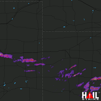 GOODLAND (KGLD) RADAR

