This weather event on May 24, 2025 includes:
2 states
26 counties,
10 cities,
and 56 zip codes.
There were 133 total properties that were impacted and have possible damage.
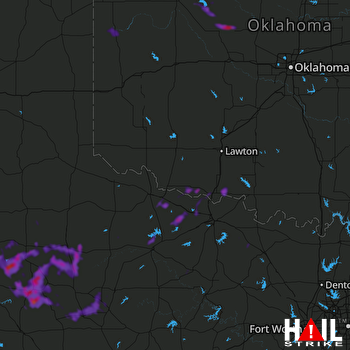 ALTUS AFB (KFDR) RADAR
States Impacted By Hail On May 24, 2025
Oklahoma
·
Texas
Counties Impacted By Hail On May 24, 2025
Blaine, OK
·
Comanche, OK
·
Cotton, OK
·
Dewey, OK
·
Ellis, OK
·
Kingfisher, OK
·
Roger Mills, OK
·
Tillman, OK
·
Archer, TX
·
Baylor, TX
·
Clay, TX
·
Crosby, TX
·
Dickens, TX
·
Fisher, TX
·
Garza, TX
·
Haskell, TX
·
Jones, TX
·
Kent, TX
·
King, TX
·
Knox, TX
·
Motley, TX
·
Scurry, TX
·
Stonewall, TX
·
Wichita, TX
·
Wilbarger, TX
·
Young, TX
Cities Impacted By Hail On May 24, 2025
Canton, OK
·
Crosbyton, TX
·
Dickens, TX
·
Girard, TX
·
Grandfield, OK
·
Guthrie, TX
·
Hamlin, TX
·
Iowa Park, TX
·
Longdale, OK
·
Watonga, OK
Zip Codes Impacted By Hail On May 24, 2025
73530
·
73531
·
73546
·
73552
·
73562
·
73568
·
73572
·
73628
·
73638
·
73642
·
73663
·
73724
·
73744
·
73755
·
73763
·
73764
·
73772
·
73832
·
76228
·
76305
·
76310
·
76351
·
76354
·
76360
·
76364
·
76365
·
76366
·
76367
·
76373
·
76374
·
76380
·
76384
·
79220
·
79227
·
79229
·
79235
·
79236
·
79256
·
79322
·
79356
·
79357
·
79370
·
79502
·
79518
·
79520
·
79521
·
79528
·
79534
·
79540
·
79543
·
79546
·
79547
·
79548
·
79549
·
79553
·
79243

