This weather event on May 24, 2025 includes:
4 states
37 counties,
14 cities,
and 81 zip codes.
There were 6200 total properties that were impacted and have possible damage.
States Impacted By Hail On May 24, 2025
Arkansas
·
Louisiana
·
Oklahoma
·
Texas
Counties Impacted By Hail On May 24, 2025
Ashley, AR
·
Bradley, AR
·
Calhoun, AR
·
Columbia, AR
·
Lafayette, AR
·
Miller, AR
·
Ouachita, AR
·
Union, AR
·
Bossier, LA
·
Caddo, LA
·
Caldwell, LA
·
Catahoula, LA
·
Claiborne, LA
·
Concordia, LA
·
De Soto, LA
·
Franklin, LA
·
Grant, LA
·
LaSalle, LA
·
Lincoln, LA
·
Morehouse, LA
·
Natchitoches, LA
·
Ouachita, LA
·
Rapides, LA
·
Richland, LA
·
Sabine, LA
·
Union, LA
·
Vernon, LA
·
Webster, LA
·
Choctaw, OK
·
Pushmataha, OK
·
Angelina, TX
·
Jasper, TX
·
Nacogdoches, TX
·
Newton, TX
·
Red River, TX
·
Sabine, TX
·
San Augustine, TX
Cities Impacted By Hail On May 24, 2025
Bossier City, LA
·
Crossett, AR
·
El Dorado, AR
·
Felsenthal, AR
·
Grambling, LA
·
Greenwood, LA
·
Hugo, OK
·
Jonesville, LA
·
Marion, LA
·
Monroe, LA
·
Pitkin, LA
·
Sawyer, OK
·
Shreveport, LA
·
Springhill, LA
Zip Codes Impacted By Hail On May 24, 2025
70656
·
71033
·
71038
·
71040
·
71046
·
71047
·
71064
·
71071
·
71072
·
71075
·
71105
·
71106
·
71107
·
71108
·
71109
·
71110
·
71111
·
71112
·
71115
·
71118
·
71119
·
71129
·
71203
·
71220
·
71235
·
71245
·
71343
·
74743
·
75980
·
71259
·
71260
·
71270
·
71280
·
71291
·
71328
·
71342
·
71360
·
71371
·
71378
·
71416
·
71417
·
71418
·
71423
·
71424
·
71429
·
71432
·
71433
·
71438
·
71447
·
71465
·
71467
·
71635
·
71646
·
71647
·
71661
·
71676
·
71701
·
71726
·
71730
·
71744
·
71747
·
71751
·
71764
·
71765
·
71770
·
71826
·
71827
·
71834
·
71860
·
71861
·
74562
·
74735
·
74756
·
75412
·
75436
·
75929
·
75932
·
75944
·
75948
·
75972
·
75977
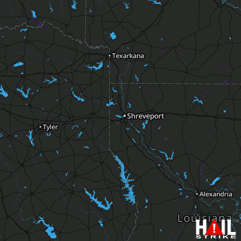 SHREVEPORT (KSHV) RADAR

