This weather event on May 21, 2025 includes:
3 states
21 counties,
33 cities,
and 71 zip codes.
There were 722 total properties that were impacted and have possible damage.
States Impacted By Hail On May 21, 2025
Arkansas
·
Missouri
·
Tennessee
Counties Impacted By Hail On May 21, 2025
Baxter, AR
·
Boone, AR
·
Carroll, AR
·
Cleburne, AR
·
Craighead, AR
·
Crittenden, AR
·
Fulton, AR
·
Independence, AR
·
Izard, AR
·
Jackson, AR
·
Lawrence, AR
·
Marion, AR
·
Mississippi, AR
·
Newton, AR
·
Poinsett, AR
·
Searcy, AR
·
Sharp, AR
·
Stone, AR
·
Stone, MO
·
Shelby, TN
·
Tipton, TN
Cities Impacted By Hail On May 21, 2025
Alicia, AR
·
Ash Flat, AR
·
Bartlett, TN
·
Bay, AR
·
Big Flat, AR
·
Cash, AR
·
Cherokee Village, AR
·
Concord, AR
·
Dyess, AR
·
Egypt, AR
·
Eureka Springs, AR
·
Fifty-Six, AR
·
Flippin, AR
·
Harrison, AR
·
Highland, AR
·
Horseshoe Bend, AR
·
Hoxie, AR
·
Jonesboro, AR
·
Lakeland, TN
·
Lepanto, AR
·
Lynn, AR
·
Marked Tree, AR
·
Millington, TN
·
Minturn, AR
·
Mountain View, AR
·
Pindall, AR
·
Pleasant Plains, AR
·
Strawberry, AR
·
Summit, AR
·
Trumann, AR
·
Valley Springs, AR
·
Western Grove, AR
·
Yellville, AR
Zip Codes Impacted By Hail On May 21, 2025
38002
·
38004
·
38023
·
38053
·
38135
·
65681
·
65747
·
72020
·
72330
·
72350
·
72354
·
72365
·
72384
·
72386
·
72404
·
72410
·
72415
·
72416
·
72421
·
72427
·
72432
·
72433
·
72434
·
72440
·
72445
·
72458
·
72459
·
72466
·
72469
·
72471
·
72472
·
72476
·
72479
·
72482
·
72501
·
72512
·
72513
·
72519
·
72523
·
72529
·
72530
·
72532
·
72533
·
72534
·
72539
·
72542
·
72550
·
72554
·
72555
·
72560
·
72567
·
72568
·
72601
·
72611
·
72616
·
72617
·
72631
·
72632
·
72633
·
72634
·
72638
·
72639
·
72658
·
72669
·
72675
·
72677
·
72685
·
72687
·
72338
·
72411
·
72569
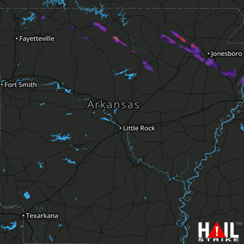 LITTLE ROCK (KLZK) RADAR

