This weather event on May 21, 2025 includes:
4 states
13 counties,
37 cities,
and 57 zip codes.
There were 3742 total properties that were impacted and have possible damage.
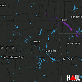 TULSA (KINX) RADAR
States Impacted By Hail On May 21, 2025
Arkansas
·
Kansas
·
Missouri
·
Oklahoma
Counties Impacted By Hail On May 21, 2025
Boone, AR
·
Carroll, AR
·
Newton, AR
·
Cherokee, KS
·
Labette, KS
·
Montgomery, KS
·
Neosho, KS
·
Barry, MO
·
Jasper, MO
·
McDonald, MO
·
Newton, MO
·
Stone, MO
·
Ottawa, OK
Cities Impacted By Hail On May 21, 2025
Alpena, AR
·
Altamont, KS
·
Arrow Point, MO
·
Bellefonte, AR
·
Berryville, AR
·
Carl Junction, MO
·
Cassville, MO
·
Chetopa, KS
·
Diamond, MO
·
Duquesne, MO
·
Emerald Beach, MO
·
Exeter, MO
·
Fairview, MO
·
Galena, KS
·
Golden, MO
·
Granby, MO
·
Green Forest, AR
·
Harrison, AR
·
Holiday Island, AR
·
Joplin, MO
·
Leawood, MO
·
Loma Linda, MO
·
Miami, OK
·
Newtonia, MO
·
Oak Grove, AR
·
Oswego, KS
·
Parsons, KS
·
Quapaw, OK
·
Ritchey, MO
·
Saginaw, MO
·
Seneca, MO
·
Shell Knob, MO
·
Shoal Creek Drive, MO
·
Stark City, MO
·
Valley Springs, AR
·
West Mineral, KS
·
Wheaton, MO
Zip Codes Impacted By Hail On May 21, 2025
64801
·
64804
·
64834
·
64840
·
64842
·
64843
·
64844
·
64850
·
64861
·
64865
·
64866
·
64874
·
65605
·
65625
·
65641
·
65647
·
65658
·
65681
·
65723
·
65730
·
65734
·
65745
·
65747
·
65772
·
66713
·
66725
·
66728
·
66739
·
66740
·
66753
·
66770
·
66773
·
66778
·
67301
·
67330
·
67332
·
67335
·
67336
·
67354
·
67356
·
67357
·
72601
·
72611
·
72616
·
72631
·
72632
·
72633
·
72638
·
72648
·
72660
·
72685
·
74339
·
74354
·
74360
·
74363
·
74370
·
65611

