This weather event on May 21, 2025 includes:
4 states
16 counties,
36 cities,
and 56 zip codes.
There were 1436 total properties that were impacted and have possible damage.
States Impacted By Hail On May 21, 2025
Arkansas
·
Kansas
·
Missouri
·
Oklahoma
Counties Impacted By Hail On May 21, 2025
Baxter, AR
·
Boone, AR
·
Carroll, AR
·
Marion, AR
·
Searcy, AR
·
Stone, AR
·
Cherokee, KS
·
Labette, KS
·
Barry, MO
·
Jasper, MO
·
McDonald, MO
·
Newton, MO
·
Ozark, MO
·
Stone, MO
·
Taney, MO
·
Ottawa, OK
Cities Impacted By Hail On May 21, 2025
Altamont, KS
·
Arrow Point, MO
·
Bakersfield, MO
·
Bellefonte, AR
·
Berryville, AR
·
Cassville, MO
·
Cliff Village, MO
·
Diamond, MO
·
Duenweg, MO
·
Duquesne, MO
·
Emerald Beach, MO
·
Eureka Springs, AR
·
Exeter, MO
·
Fairview, MO
·
Fifty-Six, AR
·
Flippin, AR
·
Golden, MO
·
Granby, MO
·
Grand Falls Plaza, MO
·
Harrison, AR
·
Holiday Island, AR
·
Joplin, MO
·
Lead Hill, AR
·
Newtonia, MO
·
Oronogo, MO
·
Redings Mill, MO
·
Saginaw, MO
·
Shell Knob, MO
·
Shoal Creek Drive, MO
·
South Lead Hill, AR
·
Stark City, MO
·
Summit, AR
·
Washburn, MO
·
Webb City, MO
·
Wheaton, MO
·
Yellville, AR
Zip Codes Impacted By Hail On May 21, 2025
64801
·
64804
·
64840
·
64841
·
64842
·
64844
·
64850
·
64855
·
64861
·
64865
·
64866
·
64867
·
64870
·
64874
·
65609
·
65625
·
65626
·
65627
·
65641
·
65647
·
65658
·
65672
·
65679
·
65681
·
65723
·
65730
·
65734
·
65745
·
65747
·
65772
·
66725
·
66728
·
66739
·
67330
·
67354
·
72519
·
72533
·
72560
·
72616
·
72617
·
72631
·
72632
·
72633
·
72634
·
72638
·
72644
·
72653
·
72658
·
72662
·
72668
·
72677
·
72685
·
72687
·
74370
·
72601
·
72639
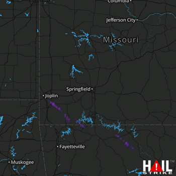 SPRINGFIELD (KSGF) RADAR

