This weather event on May 20, 2025 includes:
3 states
19 counties,
21 cities,
and 58 zip codes.
There were 262 total properties that were impacted and have possible damage.
States Impacted By Hail On May 20, 2025
Iowa
·
Illinois
·
Wisconsin
Counties Impacted By Hail On May 20, 2025
Clinton, IA
·
Bureau, IL
·
Carroll, IL
·
DeKalb, IL
·
DuPage, IL
·
Jo Daviess, IL
·
Kane, IL
·
Kendall, IL
·
LaSalle, IL
·
Lee, IL
·
Livingston, IL
·
Marshall, IL
·
Ogle, IL
·
Stephenson, IL
·
Winnebago, IL
·
Woodford, IL
·
Green, WI
·
Jefferson, WI
·
Lafayette, WI
Cities Impacted By Hail On May 20, 2025
Apple River, IL
·
Bartlett, IL
·
Bloomingdale, IL
·
Carol Stream, IL
·
Dana, IL
·
Dixon, IL
·
Glendale Heights, IL
·
Hanover Park, IL
·
Kangley, IL
·
Lee, IL
·
Long Point, IL
·
Lostant, IL
·
Millbrook, IL
·
Plano, IL
·
Princeton, IL
·
Roselle, IL
·
Shabbona, IL
·
Streator, IL
·
Warren, IL
·
Winfield, IL
·
Yorkville, IL
Zip Codes Impacted By Hail On May 20, 2025
52732
·
53137
·
53504
·
53516
·
53522
·
53541
·
53549
·
53566
·
53586
·
60103
·
60108
·
60133
·
60139
·
60151
·
60157
·
60172
·
60178
·
60185
·
60187
·
60188
·
60512
·
60530
·
60536
·
60541
·
60545
·
60550
·
60553
·
60560
·
61001
·
61010
·
61021
·
61050
·
61057
·
61064
·
61068
·
61087
·
61088
·
61089
·
61102
·
61311
·
61313
·
61318
·
61319
·
61321
·
61333
·
61334
·
61336
·
61353
·
61356
·
61358
·
61364
·
61370
·
61377
·
61378
·
61740
·
61760
·
60150
·
60190
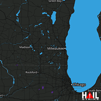 MILWAUKEE (KMKX) RADAR

