This weather event on May 20, 2025 includes:
4 states
25 counties,
23 cities,
and 59 zip codes.
There were total properties that were impacted and have possible damage.
States Impacted By Hail On May 20, 2025
Alabama
·
Kentucky
·
Mississippi
·
Tennessee
Counties Impacted By Hail On May 20, 2025
Lauderdale, AL
·
Allen, KY
·
Logan, KY
·
Simpson, KY
·
Warren, KY
·
Alcorn, MS
·
Tishomingo, MS
·
Chester, TN
·
Davidson, TN
·
Decatur, TN
·
Dickson, TN
·
Hardin, TN
·
Hickman, TN
·
Lewis, TN
·
Macon, TN
·
McNairy, TN
·
Montgomery, TN
·
Perry, TN
·
Robertson, TN
·
Smith, TN
·
Sumner, TN
·
Trousdale, TN
·
Wayne, TN
·
Williamson, TN
·
Wilson, TN
Cities Impacted By Hail On May 20, 2025
Adairville, KY
·
Adamsville, TN
·
Bethel Springs, TN
·
Burnsville, MS
·
Clifton, TN
·
Corinth, MS
·
Crump, TN
·
Eastview, TN
·
Franklin, KY
·
Guys, TN
·
Hartsville/Trousdale County, TN
·
Lebanon, TN
·
Lobelville, TN
·
Michie, TN
·
Milledgeville, TN
·
Mount Juliet, TN
·
Nashville-Davidson metropolitan government (balance), TN
·
Olivet, TN
·
Ramer, TN
·
Saltillo, TN
·
Savannah, TN
·
Selmer, TN
·
Springfield, TN
Zip Codes Impacted By Hail On May 20, 2025
35677
·
37025
·
37030
·
37031
·
37032
·
37033
·
37036
·
37051
·
37052
·
37055
·
37057
·
37064
·
37074
·
37087
·
37090
·
37096
·
37097
·
37122
·
37137
·
37172
·
37179
·
37214
·
37217
·
38310
·
38311
·
38315
·
38326
·
38327
·
38339
·
38357
·
38359
·
38361
·
38363
·
38367
·
38370
·
38371
·
38372
·
38374
·
38375
·
38376
·
38379
·
38401
·
38425
·
38462
·
38475
·
38485
·
38563
·
38833
·
38834
·
38846
·
38852
·
42104
·
42120
·
42134
·
42164
·
42202
·
42276
·
38332
·
37184
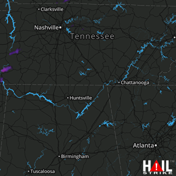 HUNTSVILLE (KHTX) RADAR

