This weather event on May 19, 2025 includes:
2 states
27 counties,
29 cities,
and 68 zip codes.
There were 322 total properties that were impacted and have possible damage.
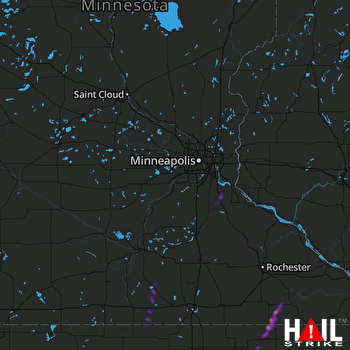 MINNEAPOLIS (KMPX) RADAR
States Impacted By Hail On May 19, 2025
Iowa
·
Minnesota
Counties Impacted By Hail On May 19, 2025
Butler, IA
·
Chickasaw, IA
·
Floyd, IA
·
Hancock, IA
·
Howard, IA
·
Humboldt, IA
·
Kossuth, IA
·
Mitchell, IA
·
Pocahontas, IA
·
Winnebago, IA
·
Winneshiek, IA
·
Blue Earth, MN
·
Carver, MN
·
Dakota, MN
·
Dodge, MN
·
Faribault, MN
·
Fillmore, MN
·
Goodhue, MN
·
Mower, MN
·
Olmsted, MN
·
Rice, MN
·
Scott, MN
·
Steele, MN
·
Wabasha, MN
·
Waseca, MN
·
Washington, MN
·
Winona, MN
Cities Impacted By Hail On May 19, 2025
Afton, MN
·
Alta Vista, IA
·
Altura, MN
·
Bassett, IA
·
Charles City, IA
·
Chester, IA
·
Coates, MN
·
Colwell, IA
·
Corwith, IA
·
Easton, MN
·
Elma, IA
·
Faribault, MN
·
Frost, MN
·
Greene, IA
·
Hampton, MN
·
Lime Springs, IA
·
Lu Verne, IA
·
Medford, MN
·
Minnesota Lake, MN
·
Northfield, MN
·
Pine Island, MN
·
Rake, IA
·
Rosemount, MN
·
Shakopee, MN
·
Vermillion, MN
·
Wesley, IA
·
Woden, IA
·
Woodbury, MN
·
Wykoff, MN
Zip Codes Impacted By Hail On May 19, 2025
50423
·
50424
·
50430
·
50435
·
50460
·
50461
·
50465
·
50466
·
50478
·
50480
·
50483
·
50484
·
50560
·
50570
·
50577
·
50581
·
50603
·
50616
·
50620
·
50628
·
50636
·
50645
·
50653
·
50659
·
52101
·
52134
·
52155
·
55001
·
55021
·
55024
·
55027
·
55031
·
55033
·
55057
·
55060
·
55068
·
55085
·
55129
·
55368
·
55379
·
55387
·
55910
·
55923
·
55935
·
55939
·
55951
·
55955
·
55956
·
55959
·
55961
·
55963
·
55965
·
55969
·
55975
·
55990
·
55992
·
56013
·
56014
·
56025
·
56027
·
56033
·
56048
·
56065
·
56068
·
56093
·
56097
·
55386
·
55049

