This weather event on May 19, 2025 includes:
4 states
18 counties,
34 cities,
and 58 zip codes.
There were total properties that were impacted and have possible damage.
States Impacted By Hail On May 19, 2025
Illinois
·
Kentucky
·
Missouri
·
Tennessee
Counties Impacted By Hail On May 19, 2025
Jackson, IL
·
Monroe, IL
·
Randolph, IL
·
Logan, KY
·
Ohio, KY
·
Simpson, KY
·
Cape Girardeau, MO
·
Jefferson, MO
·
Perry, MO
·
Scott, MO
·
Ste. Genevieve, MO
·
St. Louis, MO
·
Stoddard, MO
·
Cheatham, TN
·
Dickson, TN
·
Montgomery, TN
·
Robertson, TN
·
Sumner, TN
Cities Impacted By Hail On May 19, 2025
Adairville, KY
·
Adams, TN
·
Affton, MO
·
Allenville, MO
·
Arnold, MO
·
Brentwood, MO
·
Cape Girardeau, MO
·
Cedar Hill, TN
·
Chaffee, MO
·
Chester, IL
·
Clarksville, TN
·
Concord, MO
·
Crestwood, MO
·
Crystal City, MO
·
Delta, MO
·
Festus, MO
·
Franklin, KY
·
Grantwood Village, MO
·
Herculaneum, MO
·
Jackson, MO
·
Ladue, MO
·
Longtown, MO
·
Maplewood, MO
·
Marlborough, MO
·
Oak Ridge, MO
·
Orlinda, TN
·
Portland, TN
·
Richmond Heights, MO
·
Rock Hill, MO
·
Sappington, MO
·
Shrewsbury, MO
·
Sunset Hills, MO
·
Webster Groves, MO
·
Whitewater, MO
Zip Codes Impacted By Hail On May 19, 2025
37015
·
37032
·
37035
·
37040
·
37042
·
37043
·
37048
·
37049
·
37051
·
37052
·
37146
·
37148
·
37172
·
37191
·
42134
·
42202
·
42204
·
42265
·
42320
·
62233
·
62241
·
62277
·
62295
·
62297
·
62907
·
63010
·
63019
·
63028
·
63048
·
63070
·
63117
·
63119
·
63123
·
63124
·
63126
·
63128
·
63143
·
63144
·
63627
·
63670
·
63673
·
63701
·
63730
·
63732
·
63735
·
63740
·
63745
·
63748
·
63755
·
63769
·
63771
·
63774
·
63775
·
63785
·
37010
·
37036
·
37142
·
63744
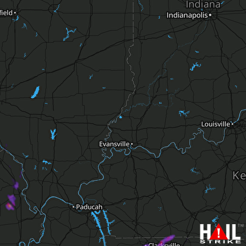 EVANSVILLE (KVWX) RADAR

