This weather event on May 19, 2025 includes:
2 states
19 counties,
17 cities,
and 51 zip codes.
There were 847 total properties that were impacted and have possible damage.
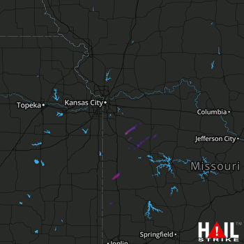 KANSAS CITY (KEAX) RADAR
States Impacted By Hail On May 19, 2025
Kansas
·
Missouri
Counties Impacted By Hail On May 19, 2025
Crawford, KS
·
Linn, KS
·
Barton, MO
·
Bates, MO
·
Caldwell, MO
·
Carroll, MO
·
Cass, MO
·
Grundy, MO
·
Henry, MO
·
Howard, MO
·
Johnson, MO
·
Lafayette, MO
·
Livingston, MO
·
Mercer, MO
·
Montgomery, MO
·
Pettis, MO
·
Ray, MO
·
Sullivan, MO
·
Vernon, MO
Cities Impacted By Hail On May 19, 2025
Bronaugh, MO
·
Carrollton, MO
·
Chilhowee, MO
·
Creighton, MO
·
East Lynne, MO
·
Garden City, MO
·
Gunn City, MO
·
Harwood, MO
·
Holden, MO
·
Kingsville, MO
·
Laredo, MO
·
Leeton, MO
·
Metz, MO
·
New Franklin, MO
·
Rich Hill, MO
·
Urich, MO
·
Warrensburg, MO
Zip Codes Impacted By Hail On May 19, 2025
63361
·
64019
·
64037
·
64040
·
64080
·
64093
·
64622
·
64623
·
64630
·
64633
·
64635
·
64637
·
64641
·
64643
·
64645
·
64646
·
64652
·
64671
·
64673
·
64682
·
64683
·
64701
·
64720
·
64723
·
64726
·
64728
·
64730
·
64733
·
64739
·
64743
·
64747
·
64750
·
64752
·
64759
·
64761
·
64762
·
64765
·
64771
·
64772
·
64779
·
64788
·
64790
·
65248
·
65274
·
65336
·
65337
·
66040
·
66701
·
66734
·
64061
·
63363

