Hail Map For May 18, 2025 (KFWS)

This weather event on May 18, 2025 includes: 1 states 9 counties, 18 cities, and 43 zip codes.
There were 110 total properties that were impacted and have possible damage.
Preview image 
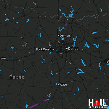
DALLAS/FTW (KFWS) RADAR
Weather Data Verified By
Data provided by NOAA. Data provided by NWS.

Impact Score

1

Hail Size

Average 1.1"
Maximum 1.3"

Storm Details

Start Time
01:14 PM
Properties
110
Spotters
0

States Impacted By Hail On May 18, 2025

Texas

Counties Impacted By Hail On May 18, 2025

Bell, TX · Burnet, TX · Collin, TX · Cooke, TX · Denton, TX · Ellis, TX · Falls, TX · Grayson, TX · Limestone, TX

Cities Impacted By Hail On May 18, 2025

Burnet, TX · Celina, TX · Collinsville, TX · Corinth, TX · Denton, TX · Dorchester, TX · Gainesville, TX · Groesbeck, TX · Harker Heights, TX · Killeen, TX · Morgan's Point Resort, TX · Nolanville, TX · Red Oak, TX · Sadler, TX · Sherman, TX · Southmayd, TX · Temple, TX · Troy, TX

Zip Codes Impacted By Hail On May 18, 2025

75009 · 75092 · 75154 · 75165 · 75459 · 76065 · 76201 · 76207 · 76208 · 76210 · 76227 · 76233 · 76240 · 76258 · 76266 · 76268 · 76271 · 76272 · 76273 · 76501 · 76502 · 76513 · 76524 · 76527 · 76542 · 76548 · 76549 · 76550 · 76559 · 76571 · 76579 · 76632 · 76642 · 76653 · 76661 · 76664 · 76682 · 76687 · 78605 · 78608 · 78611 · 76264 · 76504