This weather event on May 17, 2025 includes:
3 states
18 counties,
21 cities,
and 73 zip codes.
There were 1937 total properties that were impacted and have possible damage.
States Impacted By Hail On May 17, 2025
Kansas
·
Missouri
·
Oklahoma
Counties Impacted By Hail On May 17, 2025
Allen, KS
·
Anderson, KS
·
Bourbon, KS
·
Coffey, KS
·
Crawford, KS
·
Franklin, KS
·
Greenwood, KS
·
Linn, KS
·
Lyon, KS
·
Miami, KS
·
Neosho, KS
·
Osage, KS
·
Wilson, KS
·
Woodson, KS
·
Barton, MO
·
Cedar, MO
·
Vernon, MO
·
Osage, OK
Cities Impacted By Hail On May 17, 2025
Burlington, KS
·
Chanute, KS
·
Coyville, KS
·
Emporia, KS
·
Fort Scott, KS
·
Girard, KS
·
Harris, KS
·
Humboldt, KS
·
La Harpe, KS
·
Mildred, KS
·
Moran, KS
·
Moundville, MO
·
Neosho Falls, KS
·
Nevada, MO
·
Rantoul, KS
·
Savonburg, KS
·
Stark, KS
·
Toronto, KS
·
Welda, KS
·
Wellsville, KS
·
Yates Center, KS
Zip Codes Impacted By Hail On May 17, 2025
64728
·
64741
·
64759
·
64767
·
64771
·
64772
·
64778
·
64784
·
66010
·
66014
·
66864
·
66780
·
66076
·
66015
·
66032
·
66039
·
66040
·
66056
·
66064
·
66067
·
66071
·
66072
·
66078
·
66079
·
66080
·
66091
·
66092
·
66093
·
66095
·
66510
·
66528
·
66701
·
66716
·
66717
·
66720
·
66724
·
66732
·
66733
·
66736
·
66740
·
66741
·
66743
·
66746
·
66748
·
66749
·
66751
·
66753
·
66754
·
66755
·
66758
·
66761
·
66762
·
66769
·
66771
·
66772
·
66775
·
66777
·
66779
·
66783
·
66801
·
66839
·
66852
·
66853
·
66854
·
66857
·
66870
·
66871
·
67045
·
67047
·
67137
·
67357
·
74652
·
64744
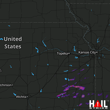 TOPEKA (KTWX) RADAR

