This weather event on May 16, 2025 includes:
2 states
17 counties,
17 cities,
and 52 zip codes.
There were 6116 total properties that were impacted and have possible damage.
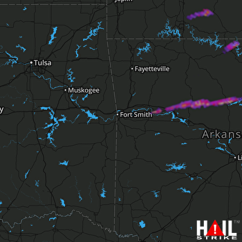 FORT SMITH (KSRX) RADAR
States Impacted By Hail On May 16, 2025
Arkansas
·
Missouri
Counties Impacted By Hail On May 16, 2025
Baxter, AR
·
Cleburne, AR
·
Franklin, AR
·
Johnson, AR
·
Logan, AR
·
Marion, AR
·
Newton, AR
·
Pope, AR
·
Searcy, AR
·
Stone, AR
·
Van Buren, AR
·
Barry, MO
·
Christian, MO
·
Douglas, MO
·
Greene, MO
·
Ozark, MO
·
Taney, MO
Cities Impacted By Hail On May 16, 2025
Altus, AR
·
Clarksville, AR
·
Clinton, AR
·
Coal Hill, AR
·
Denning, AR
·
Fairfield Bay, AR
·
Gassville, AR
·
Greers Ferry, AR
·
Hagarville, AR
·
Hartman, AR
·
Lamar, AR
·
Midway, AR
·
Mountain Home, AR
·
Saddlebrooke, MO
·
Shirley, AR
·
Springfield, MO
·
Wiederkehr Village, AR
Zip Codes Impacted By Hail On May 16, 2025
65608
·
65609
·
65614
·
65625
·
65629
·
65653
·
65657
·
65720
·
65746
·
65759
·
65771
·
65802
·
65803
·
65804
·
65806
·
65807
·
72013
·
72030
·
72031
·
72044
·
72067
·
72080
·
72088
·
72130
·
72141
·
72153
·
72530
·
72537
·
72544
·
72560
·
72623
·
72626
·
72635
·
72640
·
72651
·
72653
·
72655
·
72675
·
72685
·
72830
·
72832
·
72837
·
72839
·
72840
·
72843
·
72846
·
72854
·
72856
·
72930
·
72949
·
72821
·
72634

