This weather event on May 16, 2025 includes:
2 states
20 counties,
36 cities,
and 69 zip codes.
There were total properties that were impacted and have possible damage.
States Impacted By Hail On May 16, 2025
Kentucky
·
Tennessee
Counties Impacted By Hail On May 16, 2025
Adair, KY
·
Allen, KY
·
Barren, KY
·
Christian, KY
·
Clinton, KY
·
Cumberland, KY
·
Logan, KY
·
Metcalfe, KY
·
Monroe, KY
·
Russell, KY
·
Simpson, KY
·
Todd, KY
·
Warren, KY
·
Wayne, KY
·
Houston, TN
·
Macon, TN
·
Montgomery, TN
·
Robertson, TN
·
Stewart, TN
·
Sumner, TN
Cities Impacted By Hail On May 16, 2025
Adairville, KY
·
Adams, TN
·
Allensville, KY
·
Auburn, KY
·
Bowling Green, KY
·
Burkesville, KY
·
Cedar Hill, TN
·
Clarksville, TN
·
Coopertown, TN
·
Cross Plains, TN
·
Cumberland City, TN
·
Dover, TN
·
Edmonton, KY
·
Elkton, KY
·
Fairfield, TN
·
Fountain Run, KY
·
Franklin, KY
·
Glasgow, KY
·
Hopkinsville, KY
·
Marrowbone, KY
·
Mitchellville, TN
·
Oak Grove, KY
·
Oak Grove, TN
·
Oakland, KY
·
Orlinda, TN
·
Pembroke, KY
·
Plano, KY
·
Plum Springs, KY
·
Portland, TN
·
Russellville, KY
·
Springfield, TN
·
Summer Shade, KY
·
Tennessee Ridge, TN
·
Tompkinsville, KY
·
Trenton, KY
·
Westmoreland, TN
Zip Codes Impacted By Hail On May 16, 2025
37040
·
37042
·
37043
·
37049
·
37050
·
37052
·
37058
·
37061
·
37079
·
37083
·
37142
·
37146
·
37148
·
37171
·
37172
·
37175
·
37178
·
37188
·
37191
·
42101
·
42102
·
42103
·
42104
·
42120
·
42122
·
42123
·
42129
·
42130
·
42133
·
42134
·
42140
·
42141
·
42151
·
42153
·
42156
·
42157
·
42159
·
42160
·
42164
·
42166
·
42167
·
42170
·
42171
·
42202
·
42204
·
42206
·
42220
·
42223
·
42234
·
42256
·
42262
·
42265
·
42266
·
42276
·
42286
·
42602
·
42603
·
42629
·
42633
·
42715
·
42717
·
42728
·
42731
·
37010
·
37022
·
37032
·
37141
·
37186
·
42274
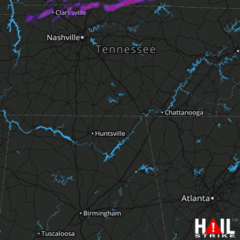 HUNTSVILLE (KHTX) RADAR

