This weather event on May 16, 2025 includes:
1 states
12 counties,
23 cities,
and 61 zip codes.
There were 2554 total properties that were impacted and have possible damage.
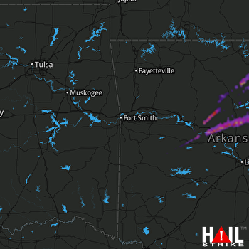 FORT SMITH (KSRX) RADAR
States Impacted By Hail On May 16, 2025
Arkansas
Counties Impacted By Hail On May 16, 2025
Cleburne, AR
·
Conway, AR
·
Faulkner, AR
·
Independence, AR
·
Izard, AR
·
Perry, AR
·
Pope, AR
·
Searcy, AR
·
Stone, AR
·
Van Buren, AR
·
White, AR
·
Yell, AR
Cities Impacted By Hail On May 16, 2025
Center Ridge, AR
·
Damascus, AR
·
Dardanelle, AR
·
Dennard, AR
·
Enola, AR
·
Fairfield Bay, AR
·
Fifty-Six, AR
·
Greenbrier, AR
·
Guion, AR
·
Guy, AR
·
Heber Springs, AR
·
Morrilton, AR
·
Mountain View, AR
·
Ola, AR
·
Pangburn, AR
·
Plainview, AR
·
Pottsville, AR
·
Quitman, AR
·
Rose Bud, AR
·
Russellville, AR
·
Shirley, AR
·
Tumbling Shoals, AR
·
Twin Groves, AR
Zip Codes Impacted By Hail On May 16, 2025
72001
·
72013
·
72025
·
72027
·
72030
·
72031
·
72039
·
72044
·
72047
·
72051
·
72058
·
72061
·
72063
·
72067
·
72080
·
72088
·
72110
·
72111
·
72121
·
72127
·
72130
·
72131
·
72137
·
72141
·
72143
·
72153
·
72156
·
72157
·
72179
·
72501
·
72517
·
72519
·
72523
·
72530
·
72533
·
72534
·
72540
·
72543
·
72546
·
72550
·
72555
·
72556
·
72560
·
72567
·
72581
·
72629
·
72645
·
72663
·
72680
·
72802
·
72823
·
72827
·
72828
·
72833
·
72834
·
72838
·
72843
·
72853
·
72857
·
72858
·
72860

