This weather event on May 14, 2025 includes:
1 states
21 counties,
27 cities,
and 66 zip codes.
There were 400 total properties that were impacted and have possible damage.
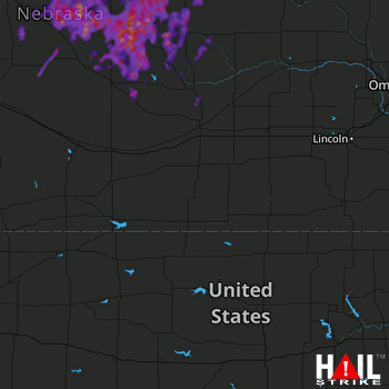 HASTINGS (KUEX) RADAR
States Impacted By Hail On May 14, 2025
Nebraska
Counties Impacted By Hail On May 14, 2025
Antelope, NE
·
Blaine, NE
·
Boone, NE
·
Brown, NE
·
Custer, NE
·
Frontier, NE
·
Garfield, NE
·
Greeley, NE
·
Hayes, NE
·
Holt, NE
·
Howard, NE
·
Lincoln, NE
·
Logan, NE
·
Loup, NE
·
McPherson, NE
·
Pierce, NE
·
Rock, NE
·
Sherman, NE
·
Thomas, NE
·
Valley, NE
·
Wheeler, NE
Cities Impacted By Hail On May 14, 2025
Arcadia, NE
·
Arnold, NE
·
Bartlett, NE
·
Brewster, NE
·
Brunswick, NE
·
Burwell, NE
·
Chambers, NE
·
Clearwater, NE
·
Comstock, NE
·
Cotesfield, NE
·
Elba, NE
·
Elyria, NE
·
Ericson, NE
·
Halsey, NE
·
Hershey, NE
·
Inman, NE
·
Litchfield, NE
·
Neligh, NE
·
North Loup, NE
·
North Platte, NE
·
Page, NE
·
Plainview, NE
·
Primrose, NE
·
Sargent, NE
·
Scotia, NE
·
Taylor, NE
·
Wellfleet, NE
Zip Codes Impacted By Hail On May 14, 2025
68620
·
68622
·
68627
·
68636
·
68637
·
68655
·
68665
·
68711
·
68713
·
68714
·
68720
·
68726
·
68729
·
68735
·
68742
·
68756
·
68761
·
68763
·
68766
·
68769
·
68773
·
68781
·
68813
·
68814
·
68815
·
68817
·
68821
·
68822
·
68823
·
68828
·
68831
·
68833
·
68835
·
68837
·
68838
·
68842
·
68852
·
68853
·
68855
·
68859
·
68862
·
68864
·
68872
·
68873
·
68874
·
68875
·
68879
·
68881
·
68882
·
69032
·
69038
·
69101
·
69120
·
69132
·
69143
·
69163
·
69165
·
69166
·
69167
·
69169
·
69170
·
69210
·
69217
·
68725
·
68764
·
69142

