This weather event on May 14, 2025 includes:
2 states
17 counties,
17 cities,
and 54 zip codes.
There were 417 total properties that were impacted and have possible damage.
States Impacted By Hail On May 14, 2025
Minnesota
·
Wisconsin
Counties Impacted By Hail On May 14, 2025
Aitkin, MN
·
Carlton, MN
·
Chisago, MN
·
Pine, MN
·
Winona, MN
·
Bayfield, WI
·
Buffalo, WI
·
Burnett, WI
·
Douglas, WI
·
Jackson, WI
·
La Crosse, WI
·
Polk, WI
·
Rusk, WI
·
Sawyer, WI
·
St. Croix, WI
·
Trempealeau, WI
·
Washburn, WI
Cities Impacted By Hail On May 14, 2025
Altura, MN
·
Bruno, MN
·
Deer Park, WI
·
Emerald, WI
·
Grantsburg, WI
·
Holmen, WI
·
Independence, WI
·
Melrose, WI
·
Onalaska, WI
·
Reserve, WI
·
Rock Creek, MN
·
Shell Lake, WI
·
St. Croix Falls, WI
·
Tamarack, MN
·
Taylors Falls, MN
·
Trego, WI
·
Whitehall, WI
Zip Codes Impacted By Hail On May 14, 2025
54002
·
54004
·
54007
·
54009
·
54013
·
54017
·
54024
·
54027
·
54028
·
54615
·
54636
·
54642
·
54650
·
54747
·
54755
·
54773
·
54801
·
54817
·
54819
·
54821
·
54828
·
54830
·
54832
·
54835
·
54840
·
54843
·
54845
·
54848
·
54859
·
54870
·
54871
·
54872
·
54873
·
54875
·
54876
·
54888
·
54893
·
54895
·
55063
·
55084
·
55704
·
55712
·
55760
·
55783
·
55787
·
55798
·
55910
·
55969
·
56350
·
56431
·
54001
·
54005
·
54612
·
55795
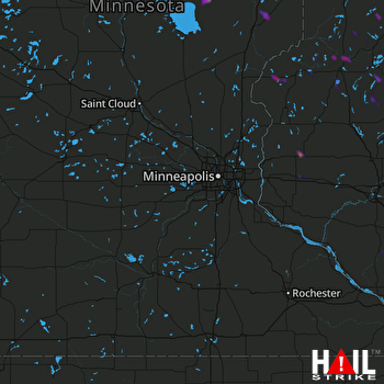 MINNEAPOLIS (KMPX) RADAR

