This weather event on May 14, 2025 includes:
2 states
18 counties,
16 cities,
and 45 zip codes.
There were 5493 total properties that were impacted and have possible damage.
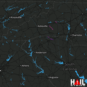 GREER (KGSP) RADAR
States Impacted By Hail On May 14, 2025
North Carolina
·
South Carolina
Counties Impacted By Hail On May 14, 2025
Burke, NC
·
Caldwell, NC
·
Catawba, NC
·
Cleveland, NC
·
Henderson, NC
·
Lincoln, NC
·
McDowell, NC
·
Polk, NC
·
Rutherford, NC
·
Cherokee, SC
·
Chesterfield, SC
·
Clarendon, SC
·
Fairfield, SC
·
Kershaw, SC
·
Lexington, SC
·
Richland, SC
·
Spartanburg, SC
·
Sumter, SC
Cities Impacted By Hail On May 14, 2025
Cayce, SC
·
Columbus, NC
·
Connelly Springs, NC
·
Drexel, NC
·
Fingerville, SC
·
Hendersonville, NC
·
Kingstown, NC
·
Lexington, SC
·
Marion, NC
·
Mayo, SC
·
Oak Grove, SC
·
Privateer, SC
·
Rutherford College, NC
·
Springdale, SC
·
Valdese, NC
·
West Columbia, SC
Zip Codes Impacted By Hail On May 14, 2025
28018
·
28092
·
28139
·
28150
·
28167
·
28168
·
28602
·
28612
·
28630
·
28645
·
28655
·
28671
·
28690
·
28722
·
28752
·
28756
·
28761
·
28773
·
28782
·
28792
·
29009
·
29033
·
29072
·
29073
·
29101
·
29102
·
29125
·
29130
·
29150
·
29154
·
29169
·
29170
·
29172
·
29180
·
29201
·
29209
·
29322
·
29323
·
29330
·
29340
·
29341
·
29349
·
29368
·
28619
·
28040

