This weather event on May 12, 2025 includes:
2 states
23 counties,
19 cities,
and 47 zip codes.
There were total properties that were impacted and have possible damage.
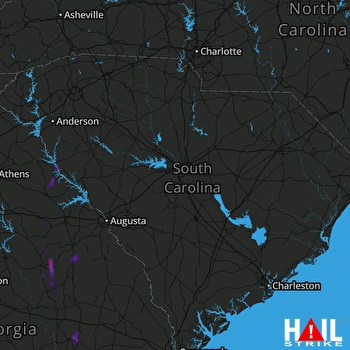 COLUMBIA (KCAE) RADAR
States Impacted By Hail On May 12, 2025
Georgia
·
South Carolina
Counties Impacted By Hail On May 12, 2025
Barrow, GA
·
Burke, GA
·
Candler, GA
·
Clarke, GA
·
Elbert, GA
·
Emanuel, GA
·
Glascock, GA
·
Jackson, GA
·
Jefferson, GA
·
Johnson, GA
·
Lincoln, GA
·
McDuffie, GA
·
Montgomery, GA
·
Oconee, GA
·
Richmond, GA
·
Tattnall, GA
·
Toombs, GA
·
Treutlen, GA
·
Warren, GA
·
Washington, GA
·
Wilkes, GA
·
Abbeville, SC
·
Laurens, SC
Cities Impacted By Hail On May 12, 2025
Arcade, GA
·
Athens-Clarke County unified government (balance), GA
·
Augusta-Richmond County consolidated government (balance), GA
·
Bogart, GA
·
Calhoun Falls, SC
·
Cobbtown, GA
·
Harrison, GA
·
Hephzibah, GA
·
Higgston, GA
·
Jefferson, GA
·
Louisville, GA
·
Lyons, GA
·
Pulaski, GA
·
Riddleville, GA
·
Sandersville, GA
·
Tennille, GA
·
Tignall, GA
·
Vidalia, GA
·
Washington, GA
Zip Codes Impacted By Hail On May 12, 2025
29325
·
29620
·
29628
·
29638
·
29639
·
29655
·
30410
·
30413
·
30420
·
30421
·
30434
·
30436
·
30439
·
30457
·
30474
·
30475
·
30477
·
30529
·
30549
·
30558
·
30567
·
30606
·
30607
·
30622
·
30635
·
30666
·
30668
·
30673
·
30680
·
30805
·
30815
·
30816
·
30820
·
30821
·
30823
·
30830
·
30833
·
30906
·
31018
·
31035
·
31049
·
31082
·
31089
·
31094
·
31096
·
30824
·
30677

