This weather event on May 9, 2025 includes:
3 states
25 counties,
23 cities,
and 67 zip codes.
There were 483 total properties that were impacted and have possible damage.
States Impacted By Hail On May 9, 2025
Georgia
·
North Carolina
·
South Carolina
Counties Impacted By Hail On May 9, 2025
Bryan, GA
·
Bulloch, GA
·
Candler, GA
·
Chatham, GA
·
Effingham, GA
·
Emanuel, GA
·
Evans, GA
·
Franklin, GA
·
Hart, GA
·
Liberty, GA
·
Montgomery, GA
·
Stephens, GA
·
Tattnall, GA
·
Toombs, GA
·
Anson, NC
·
Beaufort, SC
·
Berkeley, SC
·
Charleston, SC
·
Chester, SC
·
Chesterfield, SC
·
Colleton, SC
·
Dorchester, SC
·
Jasper, SC
·
Oconee, SC
·
Union, SC
Cities Impacted By Hail On May 9, 2025
Bloomingdale, GA
·
Collins, GA
·
Cottageville, SC
·
Dutch Island, GA
·
Garden City, GA
·
Goose Creek, SC
·
Gumlog, GA
·
Hollywood, SC
·
Isle of Hope, GA
·
Jacksonboro, SC
·
Lincolnville, SC
·
Lyons, GA
·
Meggett, SC
·
Moncks Corner, SC
·
Pooler, GA
·
Port Wentworth, GA
·
Ravenel, SC
·
Richmond Hill, GA
·
Sangaree, SC
·
Savannah, GA
·
Statesboro, GA
·
Summerville, SC
·
Vidalia, GA
Zip Codes Impacted By Hail On May 9, 2025
28133
·
29353
·
29364
·
29379
·
29432
·
29434
·
29435
·
29438
·
29446
·
29449
·
29452
·
29455
·
29461
·
29471
·
29472
·
29474
·
29477
·
29481
·
29483
·
29485
·
29488
·
29693
·
29727
·
29728
·
29742
·
29927
·
29936
·
29945
·
30410
·
30415
·
30417
·
30420
·
30421
·
30436
·
30439
·
30452
·
30453
·
30458
·
30461
·
30470
·
30474
·
30475
·
30516
·
30553
·
30557
·
30577
·
31302
·
31307
·
31308
·
31309
·
31312
·
31320
·
31321
·
31322
·
31324
·
31329
·
31404
·
31405
·
31406
·
31407
·
31408
·
31415
·
31419
·
29426
·
29470
·
29487
·
31401
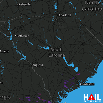 COLUMBIA (KCAE) RADAR

