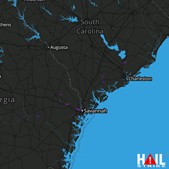
This weather event on May 9, 2025 includes:
2 states
21 counties,
16 cities,
and 56 zip codes.
There were 2159 total properties that were impacted and have possible damage.
States Impacted By Hail On May 9, 2025
Georgia
·
South Carolina
Counties Impacted By Hail On May 9, 2025
Appling, GA
·
Bryan, GA
·
Bulloch, GA
·
Candler, GA
·
Chatham, GA
·
Effingham, GA
·
Evans, GA
·
Jeff Davis, GA
·
Montgomery, GA
·
Tattnall, GA
·
Toombs, GA
·
Wheeler, GA
·
Bamberg, SC
·
Barnwell, SC
·
Beaufort, SC
·
Berkeley, SC
·
Charleston, SC
·
Colleton, SC
·
Dorchester, SC
·
Jasper, SC
·
Orangeburg, SC
Cities Impacted By Hail On May 9, 2025
Bloomingdale, GA
·
Branchville, SC
·
Cobbtown, GA
·
Cottageville, SC
·
Garden City, GA
·
Glenwood, GA
·
Hollywood, SC
·
Lodge, SC
·
Meggett, SC
·
Moncks Corner, SC
·
Pooler, GA
·
Port Wentworth, GA
·
Savannah, GA
·
Statesboro, GA
·
Summerville, SC
·
Vidalia, GA
Zip Codes Impacted By Hail On May 9, 2025
29081
·
29082
·
29426
·
29432
·
29434
·
29435
·
29438
·
29446
·
29449
·
29452
·
29461
·
29470
·
29471
·
29472
·
29474
·
29475
·
29477
·
29481
·
29483
·
29485
·
29487
·
29488
·
29853
·
29927
·
29936
·
29943
·
29945
·
30410
·
30411
·
30415
·
30417
·
30420
·
30421
·
30428
·
30436
·
30439
·
30452
·
30453
·
30458
·
30461
·
30474
·
31302
·
31307
·
31308
·
31312
·
31321
·
31322
·
31405
·
31407
·
31408
·
31415
·
31513
·
31539
·
31549
·
31563
·
31329
 CHARLESTON (KCLX) RADAR

