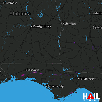
This weather event on May 9, 2025 includes:
3 states
28 counties,
21 cities,
and 70 zip codes.
There were 3430 total properties that were impacted and have possible damage.
States Impacted By Hail On May 9, 2025
Alabama
·
Florida
·
Georgia
Counties Impacted By Hail On May 9, 2025
Baldwin, AL
·
Clay, AL
·
Henry, AL
·
Houston, AL
·
Bay, FL
·
Calhoun, FL
·
Franklin, FL
·
Gadsden, FL
·
Holmes, FL
·
Jackson, FL
·
Leon, FL
·
Liberty, FL
·
Okaloosa, FL
·
Wakulla, FL
·
Walton, FL
·
Washington, FL
·
Brooks, GA
·
Clay, GA
·
Crisp, GA
·
Early, GA
·
Grady, GA
·
Irwin, GA
·
Lowndes, GA
·
Terrell, GA
·
Thomas, GA
·
Tift, GA
·
Turner, GA
·
Worth, GA
Cities Impacted By Hail On May 9, 2025
Altha, FL
·
Bay Minette, AL
·
Bonifay, FL
·
Campbellton, FL
·
Carrabelle, FL
·
Cowarts, AL
·
Dawson, GA
·
DeFuniak Springs, FL
·
Destin, FL
·
Dothan, AL
·
Eglin AFB, FL
·
Fort Walton Beach, FL
·
Greensboro, FL
·
Gretna, FL
·
Havana, FL
·
Lake Lorraine, FL
·
Mary Esther, FL
·
Thomasville, GA
·
Valdosta, GA
·
Webb, AL
·
Wright, FL
Zip Codes Impacted By Hail On May 9, 2025
31015
·
31601
·
31606
·
31625
·
31629
·
31632
·
31636
·
31638
·
31712
·
31714
·
31733
·
31772
·
31774
·
31789
·
31790
·
31792
·
31793
·
31795
·
31796
·
32303
·
32312
·
32321
·
32322
·
32323
·
32324
·
32330
·
32332
·
32333
·
32351
·
32358
·
32404
·
32420
·
32421
·
32424
·
32425
·
32426
·
32427
·
32428
·
32430
·
32433
·
32435
·
32438
·
32440
·
32442
·
32455
·
32462
·
32466
·
32541
·
32542
·
32548
·
32569
·
32579
·
32580
·
36251
·
36255
·
36319
·
36320
·
36321
·
36375
·
36376
·
36507
·
36579
·
39823
·
39824
·
39826
·
39828
·
39842
·
39851
·
32448
·
31643
 FORT RUCKER (KEOX) RADAR

