This weather event on May 9, 2025 includes:
3 states
26 counties,
15 cities,
and 61 zip codes.
There were total properties that were impacted and have possible damage.
States Impacted By Hail On May 9, 2025
Alabama
·
Florida
·
Georgia
Counties Impacted By Hail On May 9, 2025
Clay, AL
·
Coffee, AL
·
Henry, AL
·
Houston, AL
·
Bay, FL
·
Calhoun, FL
·
Gadsden, FL
·
Holmes, FL
·
Jackson, FL
·
Liberty, FL
·
Okaloosa, FL
·
Walton, FL
·
Washington, FL
·
Baker, GA
·
Ben Hill, GA
·
Calhoun, GA
·
Clay, GA
·
Crisp, GA
·
Dougherty, GA
·
Early, GA
·
Lee, GA
·
Peach, GA
·
Terrell, GA
·
Tift, GA
·
Turner, GA
·
Worth, GA
Cities Impacted By Hail On May 9, 2025
Albany, GA
·
Altha, FL
·
Bonifay, FL
·
Campbellton, FL
·
Columbia, AL
·
Cowarts, AL
·
Dawson, GA
·
DeFuniak Springs, FL
·
Dothan, AL
·
Fort Valley, GA
·
Gordon, AL
·
Rebecca, GA
·
Sumner, GA
·
Vernon, FL
·
Webb, AL
Zip Codes Impacted By Hail On May 9, 2025
31015
·
31030
·
31707
·
31712
·
31714
·
31721
·
31743
·
31763
·
31772
·
31781
·
31783
·
31789
·
31790
·
31791
·
31795
·
31796
·
32321
·
32324
·
32351
·
32420
·
32421
·
32424
·
32425
·
32426
·
32427
·
32428
·
32430
·
32435
·
32437
·
32438
·
32439
·
32440
·
32442
·
32448
·
32455
·
32460
·
32462
·
32466
·
32539
·
32542
·
32567
·
36251
·
36303
·
36312
·
36319
·
36320
·
36321
·
36343
·
36375
·
36376
·
39813
·
39823
·
39824
·
39826
·
39842
·
39846
·
39851
·
39870
·
39861
·
36477
·
31793
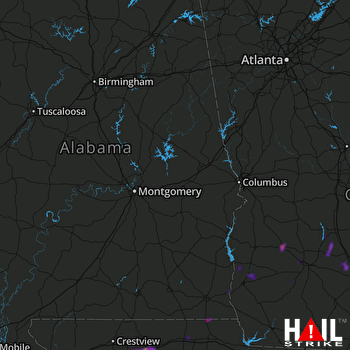 MONTGOMERY (KMXX) RADAR

