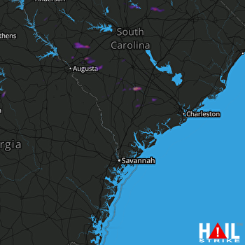
This weather event on May 8, 2025 includes:
2 states
29 counties,
16 cities,
and 89 zip codes.
There were 2676 total properties that were impacted and have possible damage.
States Impacted By Hail On May 8, 2025
Georgia
·
South Carolina
Counties Impacted By Hail On May 8, 2025
Baldwin, GA
·
Columbia, GA
·
Glascock, GA
·
Greene, GA
·
Hancock, GA
·
Jones, GA
·
Putnam, GA
·
Taliaferro, GA
·
Warren, GA
·
Abbeville, SC
·
Aiken, SC
·
Allendale, SC
·
Bamberg, SC
·
Barnwell, SC
·
Chester, SC
·
Colleton, SC
·
Darlington, SC
·
Dorchester, SC
·
Edgefield, SC
·
Fairfield, SC
·
Greenwood, SC
·
Hampton, SC
·
Kershaw, SC
·
Lancaster, SC
·
Lee, SC
·
McCormick, SC
·
Orangeburg, SC
·
Saluda, SC
·
Union, SC
Cities Impacted By Hail On May 8, 2025
Bamberg, SC
·
Carlisle, SC
·
Crooked Creek, GA
·
Edgefield, SC
·
Evans, GA
·
Graniteville, SC
·
Hampton, SC
·
Johnston, SC
·
Milledgeville, GA
·
Promised Land, SC
·
Ridge Spring, SC
·
Summerville, SC
·
Varnville, SC
·
Walterboro, SC
·
Warrenville, SC
·
Windsor, SC
Zip Codes Impacted By Hail On May 8, 2025
29003
·
29006
·
29009
·
29010
·
29014
·
29015
·
29018
·
29020
·
29030
·
29031
·
29032
·
29038
·
29042
·
29067
·
29074
·
29081
·
29082
·
29101
·
29105
·
29107
·
29112
·
29115
·
29118
·
29129
·
29130
·
29133
·
29137
·
29142
·
29146
·
29178
·
29180
·
29379
·
29432
·
29435
·
29437
·
29456
·
29472
·
29474
·
29475
·
29477
·
29481
·
29488
·
29620
·
29628
·
29646
·
29712
·
29714
·
29729
·
29801
·
29803
·
29805
·
29810
·
29812
·
29817
·
29819
·
29821
·
29824
·
29829
·
29832
·
29836
·
29842
·
29843
·
29847
·
29849
·
29851
·
29853
·
29856
·
29860
·
29916
·
29924
·
29929
·
29944
·
29945
·
30631
·
30642
·
30678
·
30802
·
30810
·
30821
·
30823
·
31024
·
31033
·
31061
·
31062
·
31087
·
30809
·
29485
·
29471
·
29164
 CHARLESTON (KCLX) RADAR

