This weather event on May 8, 2025 includes:
4 states
22 counties,
10 cities,
and 71 zip codes.
There were 21 total properties that were impacted and have possible damage.
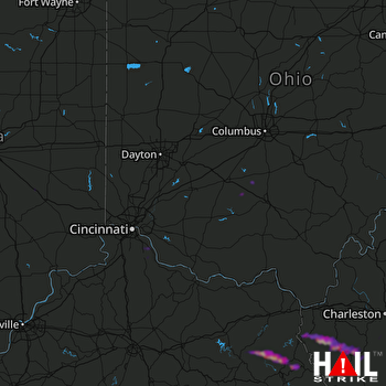 CINCINNATI (KILN) RADAR
States Impacted By Hail On May 8, 2025
Indiana
·
Kentucky
·
Ohio
·
West Virginia
Counties Impacted By Hail On May 8, 2025
Rush, IN
·
Shelby, IN
·
Breathitt, KY
·
Campbell, KY
·
Elliott, KY
·
Floyd, KY
·
Johnson, KY
·
Kenton, KY
·
Knott, KY
·
Lawrence, KY
·
Magoffin, KY
·
Martin, KY
·
Morgan, KY
·
Pike, KY
·
Clermont, OH
·
Highland, OH
·
Pickaway, OH
·
Ross, OH
·
Boone, WV
·
Lincoln, WV
·
Logan, WV
·
Wayne, WV
Cities Impacted By Hail On May 8, 2025
Alexandria, KY
·
Big Creek, WV
·
Chapmanville, WV
·
Claryville, KY
·
Dwale, KY
·
Fort Gay, WV
·
Fort Mitchell, KY
·
Harts, WV
·
Lakeside Park, KY
·
Prestonsburg, KY
Zip Codes Impacted By Hail On May 8, 2025
25009
·
25051
·
25053
·
25108
·
25121
·
25142
·
25154
·
25169
·
25505
·
25506
·
25508
·
25511
·
25514
·
25524
·
25534
·
25547
·
25555
·
25557
·
25565
·
25570
·
41007
·
41017
·
41059
·
41124
·
41149
·
41159
·
41171
·
41204
·
41216
·
41219
·
41226
·
41230
·
41232
·
41240
·
41250
·
41254
·
41255
·
41257
·
41262
·
41263
·
41264
·
41265
·
41317
·
41339
·
41421
·
41465
·
41472
·
41501
·
41514
·
41564
·
41571
·
41601
·
41602
·
41603
·
41607
·
41621
·
41640
·
41642
·
41653
·
41772
·
43115
·
43145
·
43164
·
45103
·
45123
·
45133
·
45628
·
46182
·
41001
·
25517
·
25512

