This weather event on May 7, 2025 includes:
3 states
17 counties,
33 cities,
and 53 zip codes.
There were 22012 total properties that were impacted and have possible damage.
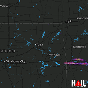 TULSA (KINX) RADAR
States Impacted By Hail On May 7, 2025
Arkansas
·
Kansas
·
Oklahoma
Counties Impacted By Hail On May 7, 2025
Crawford, AR
·
Franklin, AR
·
Johnson, AR
·
Logan, AR
·
Pope, AR
·
Scott, AR
·
Sebastian, AR
·
Yell, AR
·
Labette, KS
·
Craig, OK
·
Delaware, OK
·
Le Flore, OK
·
Nowata, OK
·
Rogers, OK
·
Seminole, OK
·
Sequoyah, OK
·
Wagoner, OK
Cities Impacted By Hail On May 7, 2025
Altus, AR
·
Arkoma, OK
·
Barling, AR
·
Blue Mountain, AR
·
Caulksville, AR
·
Cayuga, OK
·
Central City, AR
·
Clarksville, AR
·
Copeland, OK
·
Denning, AR
·
Dodge, OK
·
Fair Oaks, OK
·
Fort Smith, AR
·
Greenwood, AR
·
Gregory, OK
·
Grove, OK
·
Inola, OK
·
Kibler, AR
·
Knoxville, AR
·
Lavaca, AR
·
London, AR
·
Moffett, OK
·
Morrison Bluff, AR
·
Mulberry, AR
·
Muldrow, OK
·
New Blaine, AR
·
Ozark, AR
·
Remy, OK
·
Roland, OK
·
Scranton, AR
·
Tulsa, OK
·
Van Buren, AR
·
Wiederkehr Village, AR
Zip Codes Impacted By Hail On May 7, 2025
67342
·
72802
·
72821
·
72830
·
72832
·
72834
·
72835
·
72837
·
72840
·
72842
·
72845
·
72846
·
72847
·
72851
·
72852
·
72855
·
72863
·
72865
·
72901
·
72903
·
72904
·
72916
·
72921
·
72923
·
72928
·
72930
·
72933
·
72936
·
72937
·
72940
·
72941
·
72943
·
72946
·
72947
·
72949
·
72951
·
72956
·
72958
·
74015
·
74019
·
74036
·
74048
·
74331
·
74344
·
74369
·
74868
·
74884
·
74901
·
74930
·
74932
·
74946
·
74948
·
74954

