This weather event on May 5, 2025 includes:
4 states
19 counties,
15 cities,
and 56 zip codes.
There were total properties that were impacted and have possible damage.
States Impacted By Hail On May 5, 2025
Ohio
·
Pennsylvania
·
Virginia
·
West Virginia
Counties Impacted By Hail On May 5, 2025
Jefferson, OH
·
Fayette, PA
·
Greene, PA
·
Washington, PA
·
Alleghany, VA
·
Amherst, VA
·
Bath, VA
·
Bedford, VA
·
Botetourt, VA
·
Buena Vista, VA
·
Highland, VA
·
Rockbridge, VA
·
Brooke, WV
·
Doddridge, WV
·
Monongalia, WV
·
Ohio, WV
·
Pocahontas, WV
·
Preston, WV
·
Randolph, WV
Cities Impacted By Hail On May 5, 2025
Arbovale, WV
·
Beech Bottom, WV
·
Buchanan, VA
·
Buena Vista, VA
·
Claysville, PA
·
Durbin, WV
·
Green Bank, WV
·
Green Hills, PA
·
Mount Morris, PA
·
Point Marion, PA
·
Rayland, OH
·
Valley Grove, WV
·
West Liberty, WV
·
Wind Ridge, PA
·
Windsor Heights, WV
Zip Codes Impacted By Hail On May 5, 2025
15320
·
15323
·
15327
·
15329
·
15337
·
15341
·
15344
·
15353
·
15364
·
15370
·
15376
·
15377
·
15380
·
15451
·
15474
·
15478
·
24066
·
24416
·
24422
·
24450
·
24458
·
24460
·
24465
·
24484
·
24487
·
24523
·
24526
·
24555
·
24574
·
24578
·
24579
·
24915
·
24944
·
26003
·
26059
·
26060
·
26070
·
26074
·
26075
·
26241
·
26253
·
26264
·
26268
·
26374
·
26410
·
26411
·
26443
·
26444
·
26501
·
26520
·
26537
·
26541
·
26547
·
43943
·
15301
·
15349
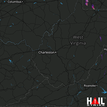 CHARLESTON (KRLX) RADAR

