This weather event on May 5, 2025 includes:
4 states
23 counties,
24 cities,
and 78 zip codes.
There were 417 total properties that were impacted and have possible damage.
States Impacted By Hail On May 5, 2025
Maryland
·
Pennsylvania
·
Virginia
·
West Virginia
Counties Impacted By Hail On May 5, 2025
Carroll, MD
·
Frederick, MD
·
Garrett, MD
·
Howard, MD
·
Washington, MD
·
Adams, PA
·
Allegheny, PA
·
Beaver, PA
·
Cambria, PA
·
Cumberland, PA
·
Greene, PA
·
Indiana, PA
·
Somerset, PA
·
Washington, PA
·
Clarke, VA
·
Frederick, VA
·
Loudoun, VA
·
Shenandoah, VA
·
Warren, VA
·
Grant, WV
·
Hampshire, WV
·
Jefferson, WV
·
Mineral, WV
Cities Impacted By Hail On May 5, 2025
Aliquippa, PA
·
Bolivar, WV
·
Braddock Heights, MD
·
Bulger, PA
·
Burkittsville, MD
·
Carroll Valley, PA
·
Edgemont, MD
·
Eldersburg, MD
·
Emmitsburg, MD
·
Green Hills, PA
·
Greensburg, MD
·
Harpers Ferry, WV
·
Hickory, PA
·
Hillsboro, VA
·
Joffre, PA
·
Lovettsville, VA
·
Middletown, MD
·
Middletown, VA
·
Midway, PA
·
Sandy Hook, MD
·
Shannondale, WV
·
Shawneeland, VA
·
Sykesville, MD
·
Wolfdale, PA
Zip Codes Impacted By Hail On May 5, 2025
15001
·
15019
·
15021
·
15026
·
15050
·
15053
·
15057
·
15060
·
15126
·
15301
·
15312
·
15323
·
15329
·
15337
·
15340
·
15341
·
15353
·
15370
·
15377
·
15531
·
15541
·
15563
·
15906
·
15926
·
15961
·
17241
·
17257
·
17307
·
17320
·
17353
·
20105
·
20117
·
20132
·
20141
·
20158
·
20175
·
20176
·
20180
·
20197
·
21048
·
21104
·
21157
·
21550
·
21561
·
21702
·
21703
·
21714
·
21718
·
21727
·
21755
·
21758
·
21769
·
21779
·
21780
·
21783
·
21784
·
21788
·
22602
·
22611
·
22620
·
22630
·
22637
·
22641
·
22645
·
22652
·
22655
·
22657
·
25425
·
25432
·
26717
·
26726
·
26739
·
26743
·
26808
·
26711
·
20135
·
15954
·
15364
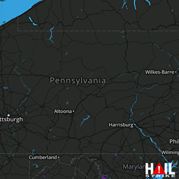 STATE COLLEGE (KCCX) RADAR

