This weather event on May 4, 2025 includes:
3 states
9 counties,
23 cities,
and 47 zip codes.
There were total properties that were impacted and have possible damage.
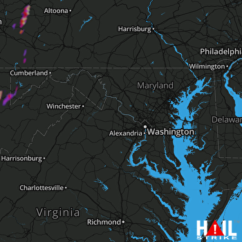 STERLING (KLWX) RADAR
States Impacted By Hail On May 4, 2025
Maryland
·
Pennsylvania
·
West Virginia
Counties Impacted By Hail On May 4, 2025
Garrett, MD
·
Indiana, PA
·
Somerset, PA
·
Westmoreland, PA
·
Barbour, WV
·
Preston, WV
·
Randolph, WV
·
Tucker, WV
·
Upshur, WV
Cities Impacted By Hail On May 4, 2025
Aurora, WV
·
Beverly, WV
·
Black Lick, PA
·
Blairsville, PA
·
Casselman, PA
·
Chevy Chase Heights, PA
·
Coral, PA
·
Crellin, MD
·
Derry, PA
·
East Dailey, WV
·
Graceton, PA
·
Homer City, PA
·
Indiana, PA
·
Kingwood, WV
·
Latrobe, PA
·
Lucerne Mines, PA
·
Millwood, PA
·
Montrose, WV
·
Mountain Lake Park, MD
·
Oakland, MD
·
Philippi, WV
·
Rowlesburg, WV
·
St. Vincent College, PA
Zip Codes Impacted By Hail On May 4, 2025
15501
·
15502
·
15540
·
15551
·
15557
·
15601
·
15620
·
15622
·
15627
·
15650
·
15658
·
15662
·
15670
·
15671
·
15681
·
15701
·
15713
·
15716
·
15717
·
15725
·
15731
·
15750
·
15754
·
15779
·
15923
·
21541
·
21550
·
26201
·
26237
·
26238
·
26250
·
26253
·
26259
·
26267
·
26283
·
26287
·
26405
·
26425
·
26440
·
26444
·
26537
·
26705
·
26716
·
26764
·
15748
·
26241
·
26416

