This weather event on May 3, 2025 includes:
3 states
21 counties,
24 cities,
and 59 zip codes.
There were 1732 total properties that were impacted and have possible damage.
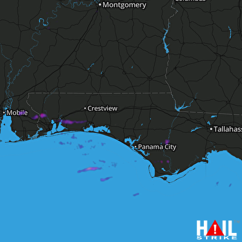 EGLIN AFB (KEVX) RADAR
States Impacted By Hail On May 3, 2025
Alabama
·
Florida
·
Georgia
Counties Impacted By Hail On May 3, 2025
Autauga, AL
·
Baldwin, AL
·
Dallas, AL
·
Elmore, AL
·
Lowndes, AL
·
Mobile, AL
·
Montgomery, AL
·
Washington, AL
·
Wilcox, AL
·
Bay, FL
·
Calhoun, FL
·
Escambia, FL
·
Franklin, FL
·
Gulf, FL
·
Liberty, FL
·
Okaloosa, FL
·
Santa Rosa, FL
·
Taylor, FL
·
Walton, FL
·
Washington, FL
·
Seminole, GA
Cities Impacted By Hail On May 3, 2025
Autaugaville, AL
·
Bagdad, FL
·
Citronelle, AL
·
Deatsville, AL
·
East Milton, FL
·
Freeport, FL
·
Gulf Breeze, FL
·
Harold, FL
·
Loxley, AL
·
Midway, FL
·
Milton, FL
·
Molino, FL
·
Montgomery, AL
·
Navarre, FL
·
Navarre Beach, FL
·
Niceville, FL
·
Pace, FL
·
Pea Ridge, FL
·
Pensacola, FL
·
Pine Level, AL
·
Stapleton, AL
·
Valparaiso, FL
·
Wewahitchka, FL
·
Woodlawn Beach, FL
Zip Codes Impacted By Hail On May 3, 2025
32321
·
32328
·
32331
·
32347
·
32404
·
32409
·
32424
·
32428
·
32435
·
32437
·
32439
·
32449
·
32455
·
32456
·
32462
·
32465
·
32501
·
32503
·
32504
·
32530
·
32531
·
32533
·
32542
·
32548
·
32561
·
32563
·
32564
·
32566
·
32570
·
32571
·
32577
·
32578
·
32580
·
32583
·
36003
·
36022
·
36025
·
36040
·
36043
·
36064
·
36066
·
36067
·
36069
·
36105
·
36108
·
36116
·
36507
·
36522
·
36527
·
36551
·
36567
·
36578
·
36703
·
36726
·
36761
·
36767
·
36773
·
36785
·
39845

