This weather event on May 1, 2025 includes:
2 states
18 counties,
29 cities,
and 59 zip codes.
There were 10926 total properties that were impacted and have possible damage.
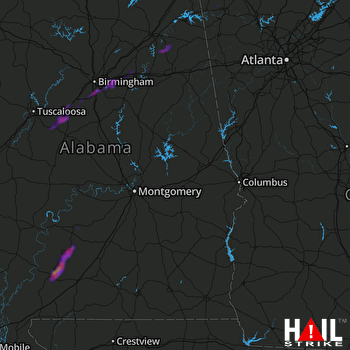 MONTGOMERY (KMXX) RADAR
States Impacted By Hail On May 1, 2025
Alabama
·
Georgia
Counties Impacted By Hail On May 1, 2025
Barbour, AL
·
Bibb, AL
·
Calhoun, AL
·
Cherokee, AL
·
Coffee, AL
·
Conecuh, AL
·
Dale, AL
·
Etowah, AL
·
Hale, AL
·
Jefferson, AL
·
Monroe, AL
·
Shelby, AL
·
St. Clair, AL
·
Talladega, AL
·
Tuscaloosa, AL
·
Wilcox, AL
·
Chattooga, GA
·
Floyd, GA
Cities Impacted By Hail On May 1, 2025
Beatrice, AL
·
Bessemer, AL
·
Brook Highland, AL
·
Dunnavant, AL
·
Excel, AL
·
Frisco City, AL
·
Glencoe, AL
·
Highland Lakes, AL
·
Homewood, AL
·
Irondale, AL
·
Lake View, AL
·
Leeds, AL
·
Lincoln, AL
·
Monroeville, AL
·
Moody, AL
·
Mountain Brook, AL
·
Ohatchee, AL
·
Peterman, AL
·
Riverside, AL
·
Rome, GA
·
Shoal Creek, AL
·
Southside, AL
·
Summerville, GA
·
Trussville, AL
·
Vance, AL
·
Vandiver, AL
·
Vestavia Hills, AL
·
West Blocton, AL
·
Woodstock, AL
Zip Codes Impacted By Hail On May 1, 2025
30105
·
30165
·
30747
·
35004
·
35020
·
35022
·
35042
·
35052
·
35094
·
35096
·
35111
·
35120
·
35125
·
35128
·
35131
·
35135
·
35147
·
35176
·
35184
·
35188
·
35209
·
35210
·
35216
·
35223
·
35226
·
35229
·
35242
·
35243
·
35244
·
35444
·
35453
·
35456
·
35474
·
35490
·
35905
·
35907
·
35953
·
35960
·
36010
·
36017
·
36048
·
36265
·
36271
·
36272
·
36279
·
36311
·
36346
·
36401
·
36425
·
36439
·
36445
·
36460
·
36471
·
36753
·
36768
·
36475
·
35173
·
35074
·
30149

