This weather event on May 1, 2025 includes:
3 states
24 counties,
20 cities,
and 75 zip codes.
There were 4179 total properties that were impacted and have possible damage.
States Impacted By Hail On May 1, 2025
Indiana
·
Kentucky
·
Ohio
Counties Impacted By Hail On May 1, 2025
Allen, IN
·
DeKalb, IN
·
Campbell, KY
·
Mason, KY
·
Adams, OH
·
Brown, OH
·
Clark, OH
·
Clermont, OH
·
Clinton, OH
·
Fairfield, OH
·
Fayette, OH
·
Franklin, OH
·
Fulton, OH
·
Greene, OH
·
Hamilton, OH
·
Henry, OH
·
Highland, OH
·
Knox, OH
·
Licking, OH
·
Logan, OH
·
Perry, OH
·
Pike, OH
·
Ross, OH
·
Warren, OH
Cities Impacted By Hail On May 1, 2025
Batavia, OH
·
Blanchester, OH
·
Chillicothe, OH
·
Gahanna, OH
·
Harveysburg, OH
·
Lake Lorelei, OH
·
Leo-Cedarville, IN
·
Martinsville, OH
·
Midland, OH
·
Milford, OH
·
Millersport, OH
·
Morrow, OH
·
New Albany, OH
·
Terrace Park, OH
·
Thurston, OH
·
Utica, OH
·
Wilberforce, OH
·
Wilmington, OH
·
Xenia, OH
·
Yellow Springs, OH
Zip Codes Impacted By Hail On May 1, 2025
41001
·
41007
·
41055
·
41056
·
43004
·
43011
·
43023
·
43031
·
43046
·
43050
·
43055
·
43060
·
43068
·
43080
·
43105
·
43130
·
43135
·
43157
·
43160
·
43213
·
43230
·
43357
·
43360
·
43515
·
43532
·
43545
·
43567
·
43748
·
43766
·
45036
·
45054
·
45068
·
45102
·
45103
·
45107
·
45113
·
45118
·
45122
·
45133
·
45140
·
45142
·
45144
·
45145
·
45146
·
45150
·
45152
·
45157
·
45159
·
45169
·
45171
·
45174
·
45176
·
45177
·
45244
·
45335
·
45370
·
45384
·
45385
·
45387
·
45502
·
45601
·
45612
·
45650
·
45661
·
45690
·
45693
·
46706
·
46765
·
46785
·
46845
·
46788
·
45644
·
45148
·
43148
·
43054
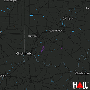 CINCINNATI (KILN) RADAR

