This weather event on April 30, 2025 includes:
1 states
15 counties,
27 cities,
and 52 zip codes.
There were total properties that were impacted and have possible damage.
States Impacted By Hail On April 30, 2025
Illinois
Counties Impacted By Hail On April 30, 2025
Adams, IL
·
Champaign, IL
·
De Witt, IL
·
Ford, IL
·
Grundy, IL
·
Hancock, IL
·
Iroquois, IL
·
Kankakee, IL
·
Knox, IL
·
Livingston, IL
·
Logan, IL
·
McLean, IL
·
Piatt, IL
·
Tazewell, IL
·
Will, IL
Cities Impacted By Hail On April 30, 2025
Ashkum, IL
·
Beason, IL
·
Bloomington, IL
·
Braceville, IL
·
Braidwood, IL
·
Carthage, IL
·
Chebanse, IL
·
Chenoa, IL
·
Clifton, IL
·
Coal City, IL
·
Diamond, IL
·
Downs, IL
·
Dwight, IL
·
Elliott, IL
·
Elwood, IL
·
Galesburg, IL
·
Gardner, IL
·
Godley, IL
·
Heyworth, IL
·
Lexington, IL
·
Loraine, IL
·
Mansfield, IL
·
Odell, IL
·
South Wilmington, IL
·
Thawville, IL
·
Waynesville, IL
·
Wilmington, IL
Zip Codes Impacted By Hail On April 30, 2025
60407
·
60408
·
60416
·
60420
·
60421
·
60424
·
60444
·
60460
·
60474
·
60481
·
60911
·
60922
·
60927
·
60930
·
60933
·
60938
·
60955
·
60957
·
60962
·
60968
·
61401
·
61458
·
61568
·
61704
·
61705
·
61724
·
61726
·
61727
·
61730
·
61736
·
61745
·
61749
·
61753
·
61754
·
61761
·
61764
·
61772
·
61776
·
61777
·
61778
·
61843
·
61845
·
61853
·
61854
·
62321
·
62349
·
62351
·
62380
·
62512
·
62518
·
61550
·
60936
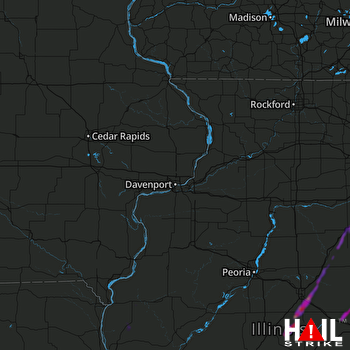 DAVENPORT (KDVN) RADAR

